Ingress Mosaic Maps
I started playing the geocaching game Ingress back in 2015, largely because of its “missions” feature—players can set up collections of waypoints for other players to visit. Since these waypoints tended to be local landmarks, completing Ingress missions was a great way to explore neat parts of unfamiliar cities on my many solo trips.
The way the game is set up, completed missions show up as a 6-column grid of mission icons in each player’s profile. Some players started submitting groups of 6, 12, 18, or some larger multiple-of-6 missions with carefully chosen icons, so if the missions were completed in a particular order, the icons would form a mosaic that showed a larger image.
I started logging my GPS tracks while completing these missions, so that I could create maps showing off my mosaic completions.
Map data © OpenStreetMap contributors
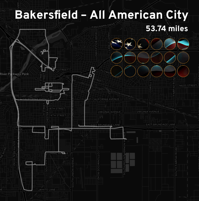
Bakersfield—All American City
Bakersfield, California, United States
Completed 27 April 2017
This mission took a deceptively long time for me to complete. The first half of the missions all took place downtown, so I was able to park the car, walk around, and complete them quickly.
Then, suddenly, the missions started getting further away, requiring me to drive to them. Even worse, their positions on the map weren’t in a logical order, so I ended up having to drive back and forth across Bakersfield, doubling back multiple times to complete the missions correctly. (I also had to find parking at every new mission, since I don’t use my phone while driving.)
So it took me quite a bit longer to complete this than it initially seemed it would, but I was able to finish it!
Map data © OpenStreetMap contributors
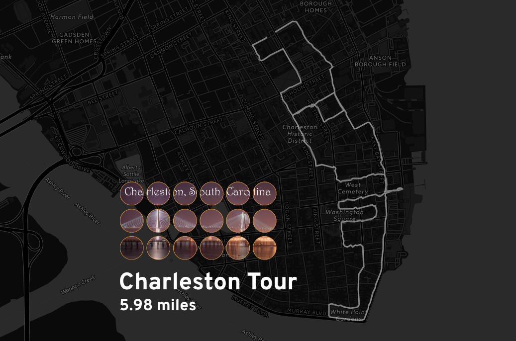
Charleston Tour
Charleston, South Carolina, United States
Completed 17 July 2017
By United States standards, Charleston is an old city. Once you’re downtown, it’s pretty easy to get anywhere by walking. This made the Charleston Tour mission into a relatively quick two-hour walk.
Map data © OpenStreetMap contributors
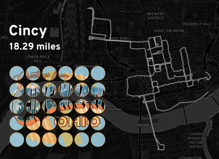
Cincy
Cincinnati, Ohio, United States
Completed 14 May 2016
Other than a wrong turn that resulted in me accidentally crossing the Ohio River, this was a pretty easy mosaic to complete.
Map data © OpenStreetMap contributors
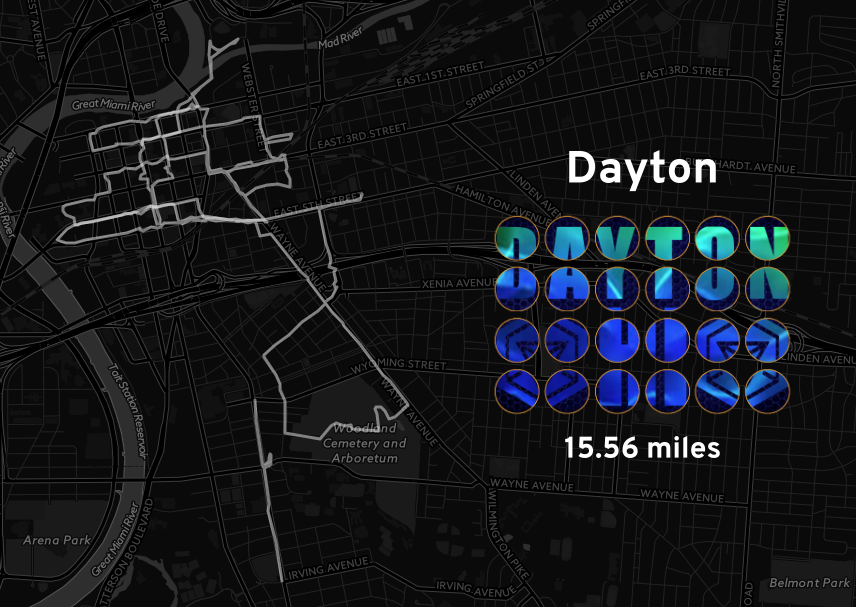
Dayton
Dayton, Ohio, United States
Completed 15 March 2015
I live near Dayton, so it’s not exactly an unfamiliar city to me, but I still enjoyed this series of walks around the city.
Map data © OpenStreetMap contributors
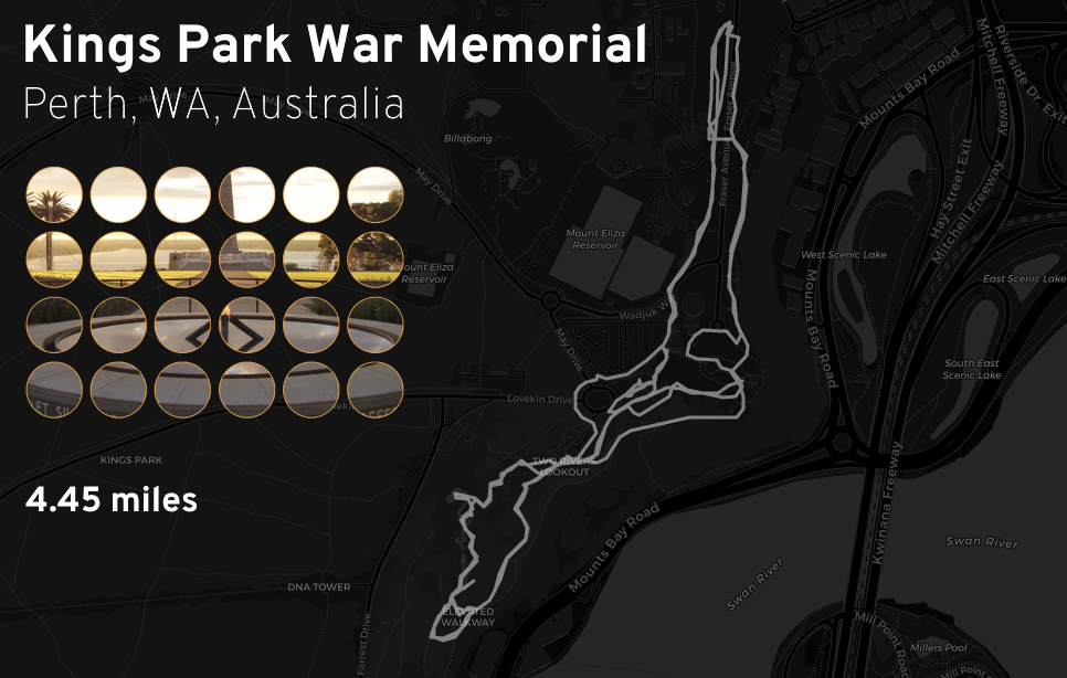
Kings Park War Memorial
Perth, Western Australia, Australia
Completed 16 February 2018
This mosaic, for some reason, required completing the same loop twice; the missions in the first half were nearly identical to the missions in the second half.
Map data © OpenStreetMap contributors
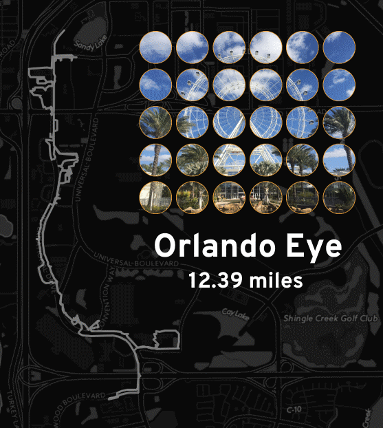
Orlando Eye
Orlando, Florida, United States
Completed 27 November 2016
I completed this mosaic in a single day, which was probably a mistake; I like walking, but twelve miles without a break left my feet a bit sore.
Map data © OpenStreetMap contributors
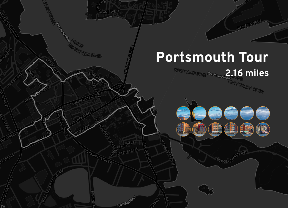
Portsmouth Tour
Portsmouth, New Hampshire, United States
Completed 11 July 2016
The 2.16 miles (3.48 km) of Portsmouth was probably the quickest mosaic I completed—only twelve missions within a quite walkable seaside town.
Map data © OpenStreetMap contributors
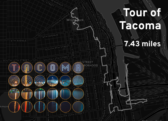
Tour of Tacoma
Tacoma, Washington, United States
Completed 25 May 2016
This one was difficult to complete. Many mosaic missions simply require visiting the waypoints, but players can also create missions that use other game mechanics—in this case, it required “capturing” the waypoints, which other players can interfere with.
I was completing the last third of this mosaic on the last night of my trip, and one particularly tenacious opposing player started slowing me down. That was fine, it’s a legitimate part of the game, but it also meant that I only just barely managed to finish before I had to head home.
Map data © OpenStreetMap contributors
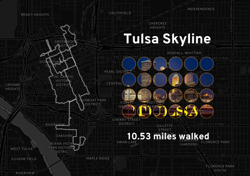
Tulsa Skyline
Tulsa, Oklahoma, United States
Completed 7 April 2016 (estimated)
Tulsa is one of my most frequently visited cities, so I was pretty familiar with downtown. However, I’d never really explored the area just south of the highway loop, so I’m glad this mission brought me somewhere new!
Map data © OpenStreetMap contributors
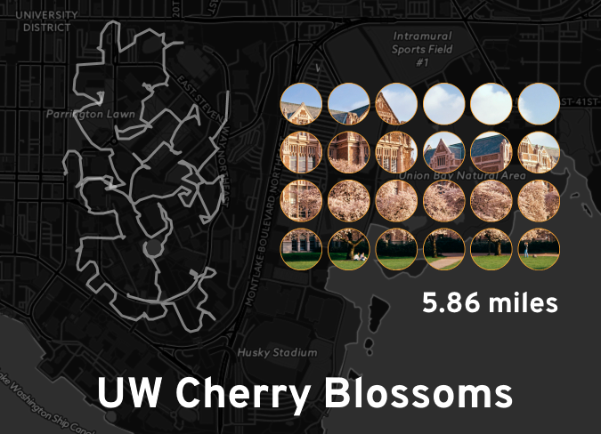
UW Cherry Blossoms
Seattle, Washington, United States
Completed 27 May 2016
I ended up with an extra day in Seattle on one trip, so I took the light rail to its then-new terminus at the University of Washington, and discovered there was a mosaic available.