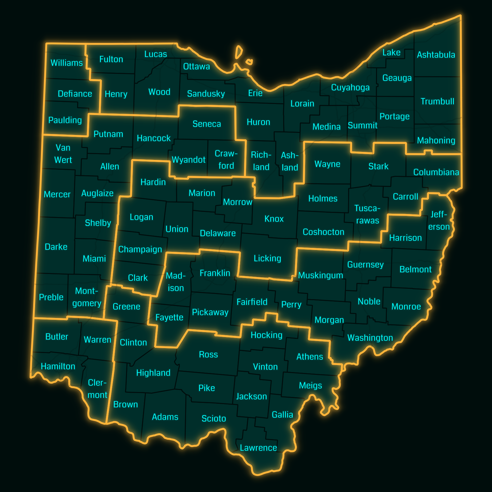
Ohio County Courthouses
I used to play the geocaching game Ingress, and one of its features is the ability to visit specific collections of waypoints. The waypoints are called portals, and their collections are called missions. Most of these missions are relatively short, with under 20 portals in a relatively small geographic area.
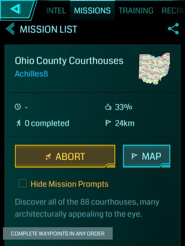
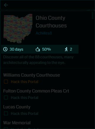
However, on a road trip that I took in early 2016, I pulled out Ingress on a break and noticed a mission called Ohio County Courthouses, which required visiting the courthouse in each of Ohio’s eighty-eight counties.
I didn’t have time to pick up the mission then, but I kept it in the back of my mind until June 2016, when Amy and I decided we would try to complete the mission over several days.
Table of Contents
Mapping the Waypoints
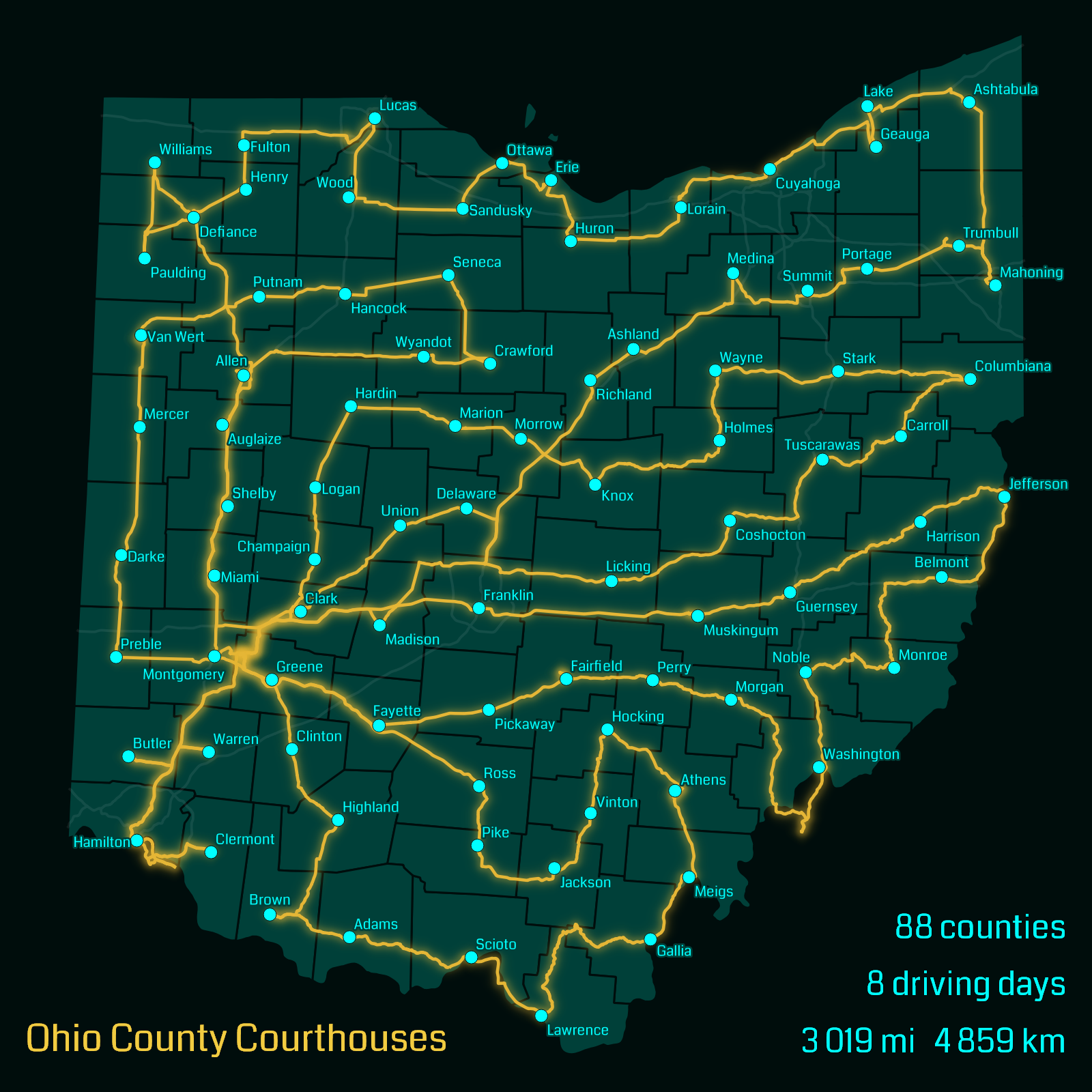
With as large as this mission was, I needed to plan out a logical route, and to do that, I needed a map. Ingress does include an in-game mission map, but at the scale of this mission, it’s too difficult to be able to see every waypoint while still being able to see the roads between them, so I decided to plot them all on Google Maps.
In order to do this, I needed the exact location of every portal. Ingress does provide an address of each portal, but it’s often just a rough range of addresses (e.g. 900–999 Main Street). Even with a specific address, you’re only finding the lot that it’s on, not the specific location of the portal itself.
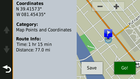
Although it would take a little research up front, I decided it would be a lot easier in the long run to work with the latitude and longitude of each of the 88 portals. I could use these coordinates to plan out my route, and once I started, I could enter the coordinates directly into my GPS.
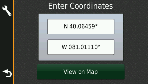
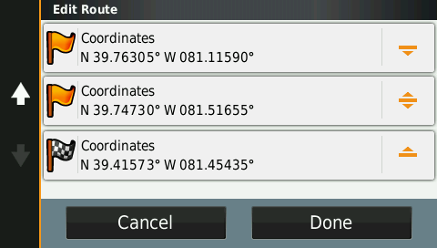
While the Ingress app doesn’t show the latitude and longitude, the Ingress Intel Map does. Click on one of the portals on the mission, then click the Link button in the upper right corner of the map page, and you’ll be given a map link that looks something like this:
https://intel.ingress.com/intel?
The second pair of numbers (after the “pll=”) are the latitude and longitude of this portal, in decimal degree format. The positive first number means the portal is in the northern hemisphere (south is negative), and the negative second number means the portal is in the western hemisphere (east is positive). Thus, the coordinates of this portal are 41.474095°N 84.551716°W.
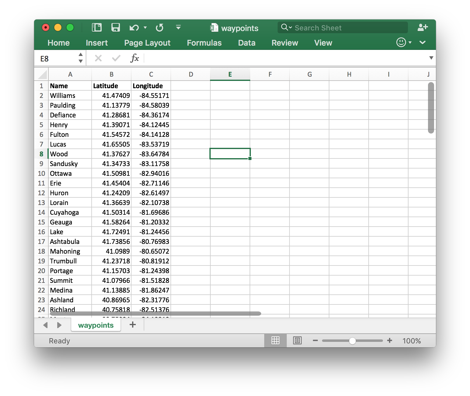
I got the latitude and longitude of all 88 portals, and placed them in an Excel spreadsheet:
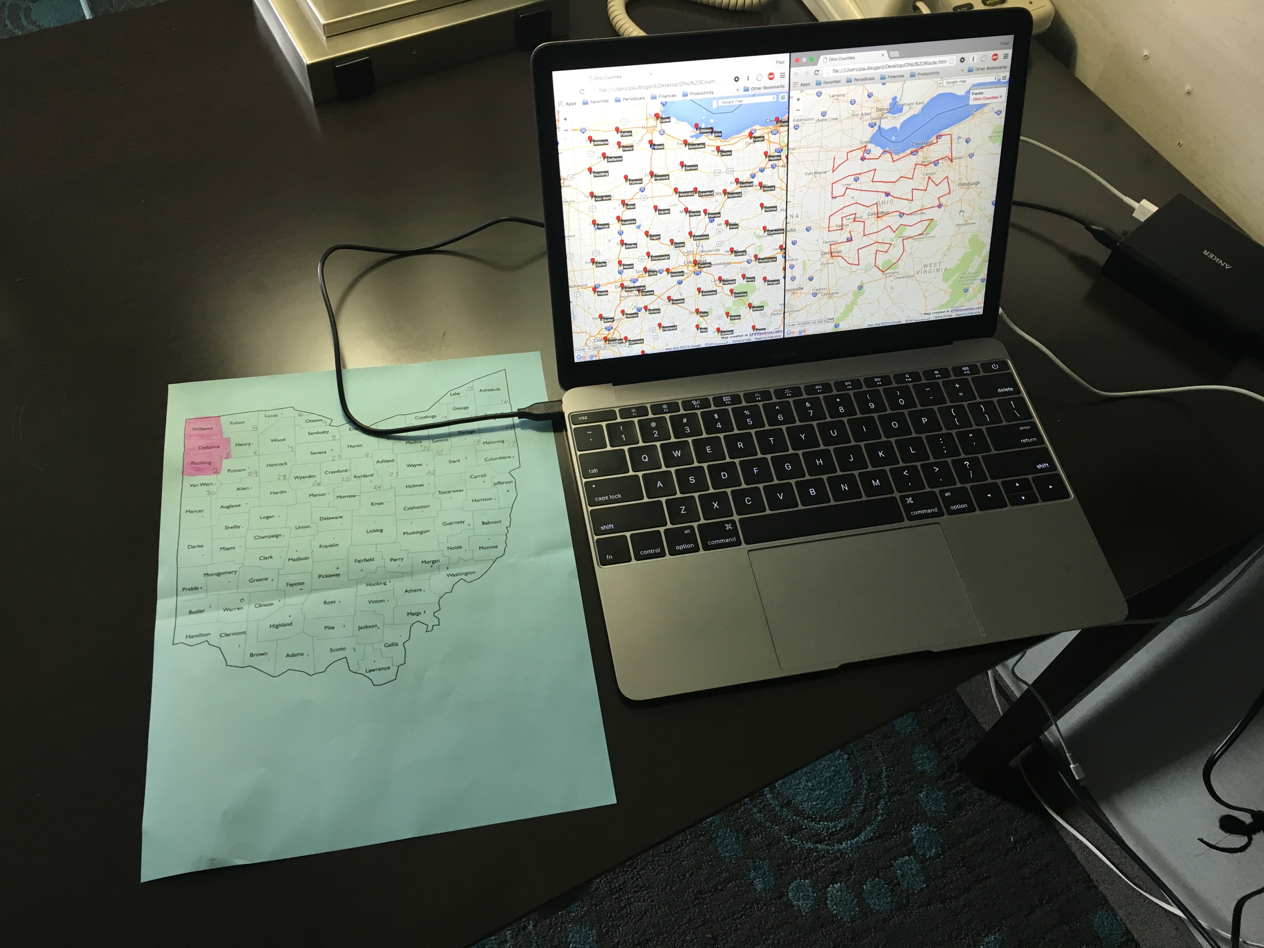
I then used GPS Visualizer to export these waypoints to Google Maps, and planned a candidate route.
Starting the Mission
Day Zero: Williams County to Defiance County
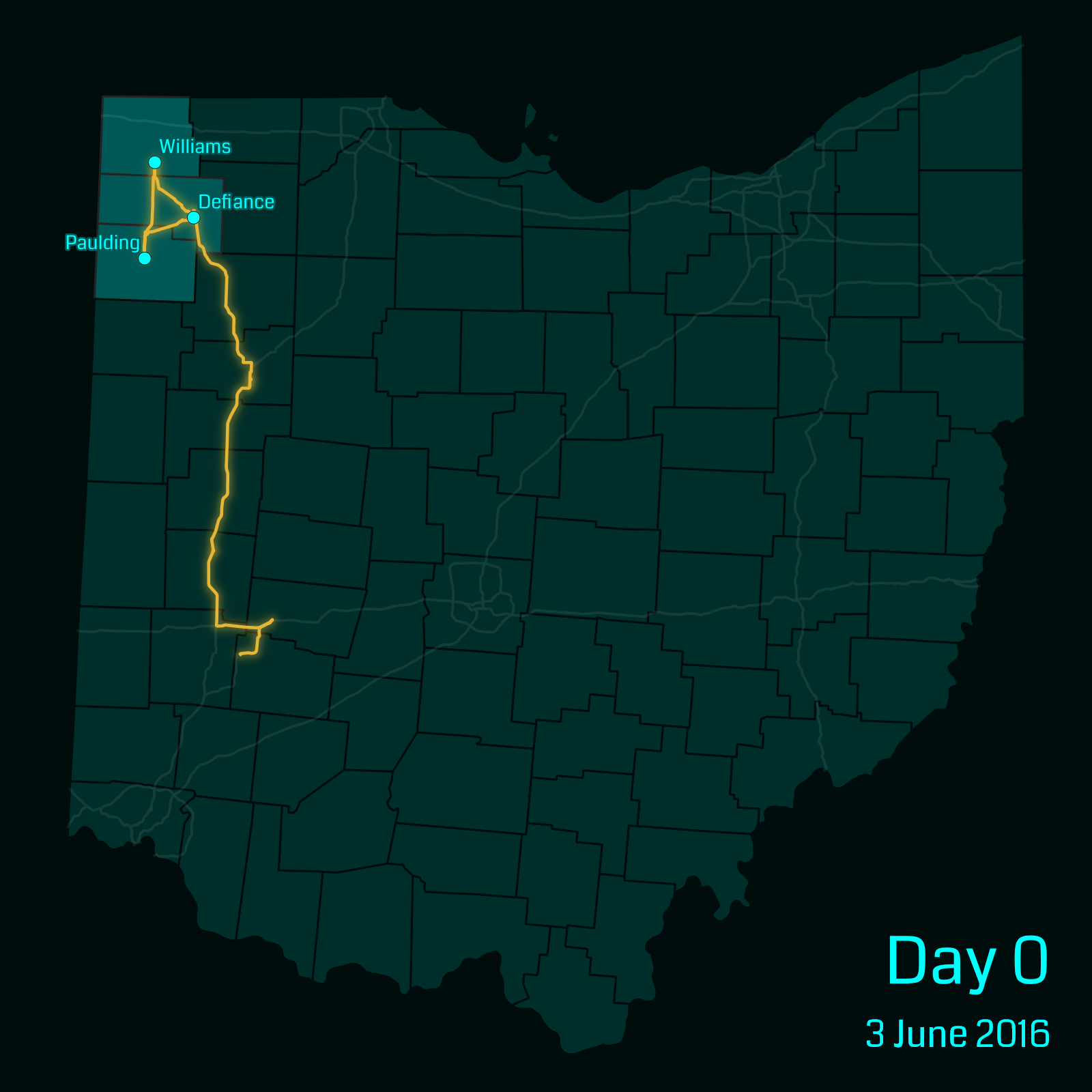
The first issue with this mission was that its first portal was in Williams county in the far northwest of Ohio. The Ingress mission list only shows nearby missions (sorted by distance to the first portal), so we had to be in the northwest corner of the state to even select the mission. On our way to Williams county, we had to drive right past a number of county seats near Interstate 75 that we’d later have to return to.
We began driving on a Friday evening after I got home from work, so by the time we started the mission and collected the first three counties’ portals, it was nearly midnight. We checked into a hotel that we’d reserved in Defiance.
Day One: Henry County to Richland County
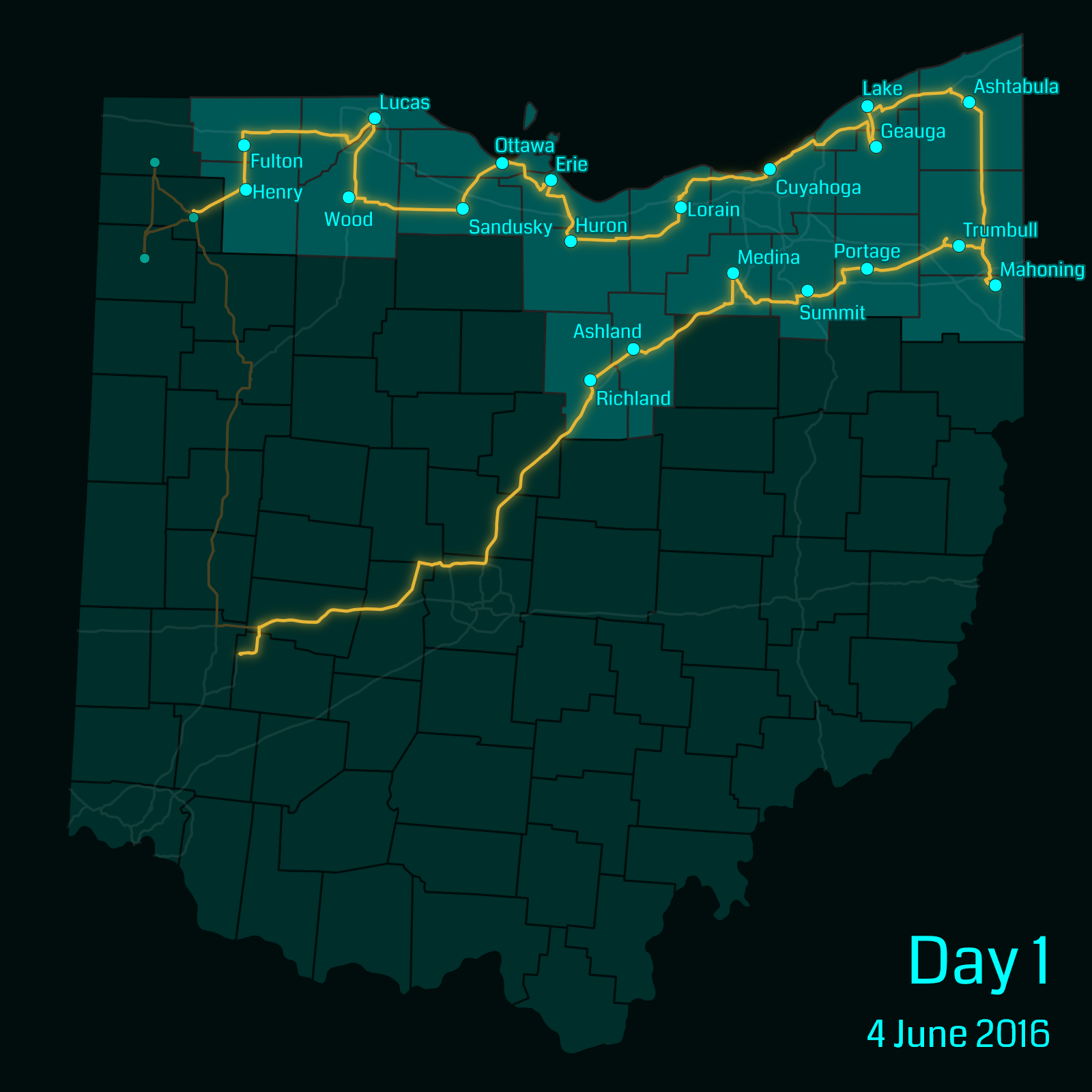
We quickly realized that traveling between county seats on back roads was not nearly as quick as we’d expected it to be. My initial estimate for doing all 88 counties was three full days (plus the few counties we’d done in day zero). However, by the time we reached Ashtabula county, it was already dinner time, and it was after midnight by the time we reached Richland county. At that point, with only 23 counties done, we had to return home.
Replanning for Realistic Travel Times
We’d wasted a lot of driving time by going home from Richland county without stopping at any further portals, and I wanted to make sure that we didn’t end up in that situation again.
I went back to my Excel sheet and Google Maps, and started planning mission days that met the following requirements:
- The mission day must be a round trip that start and ends at my home in Greene county.
- The entire round trip must be less than 12 hours of driving according to Google Maps (which would keep the mission day under 16 hours including breaks and meals).
Thus, any free weekend day we had, we would be able to go out, collect a number of mission portals, and still be home at night. I came up with the following mission day groupings, including the counties we’d already completed:
This gave us a number of roughly equal length mission days, plus a short four-county mission day in the southwest corner of the state.
Continuing the Mission
Day Two: Warren County to Clermont County
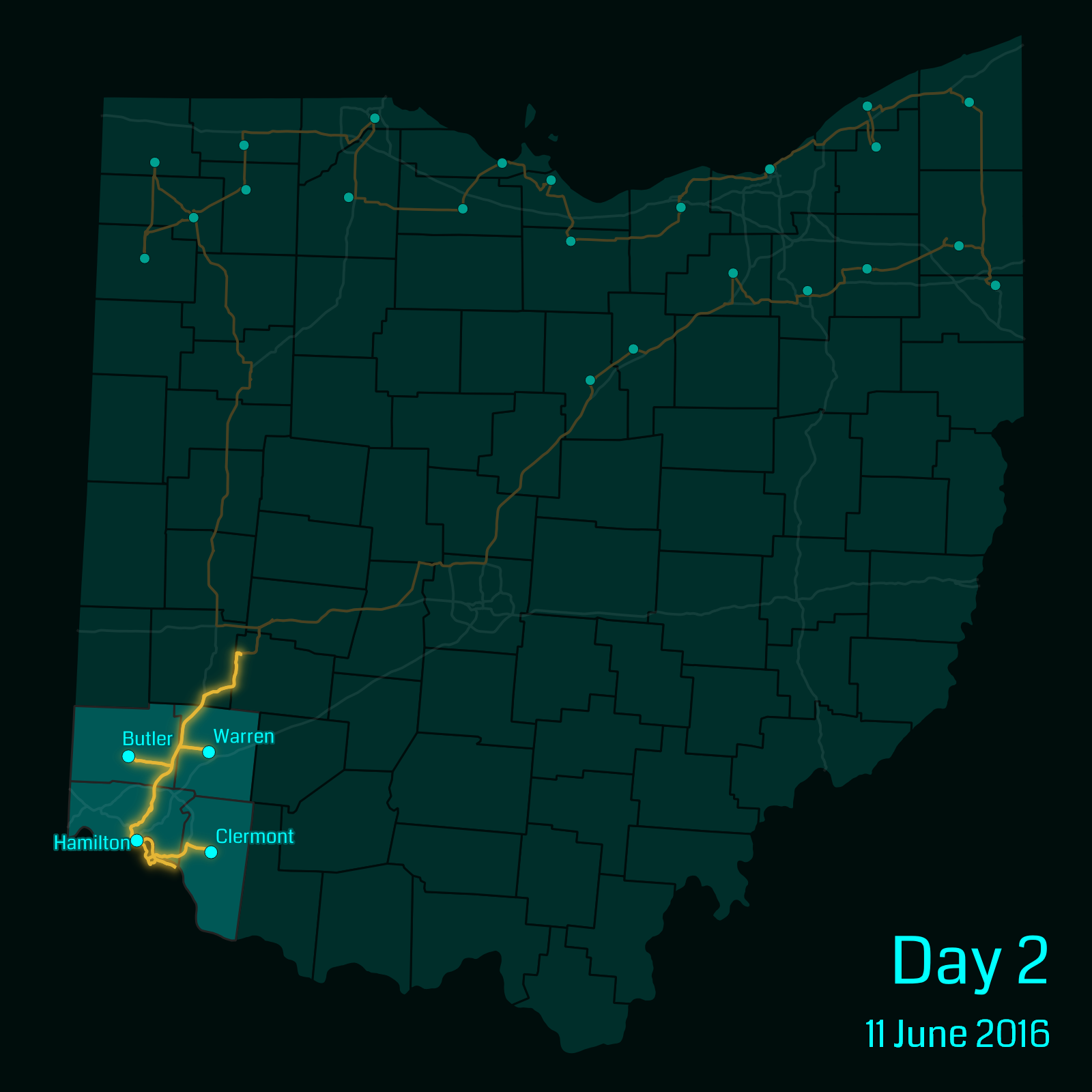
The four-county mission ended up being quite useful. One weekend, we had plans to visit a friend for dinner in the Kentucky suburbs of Cincinnati, so we picked up four quick portals on the way.
Day Three: Clark County to Champaign County
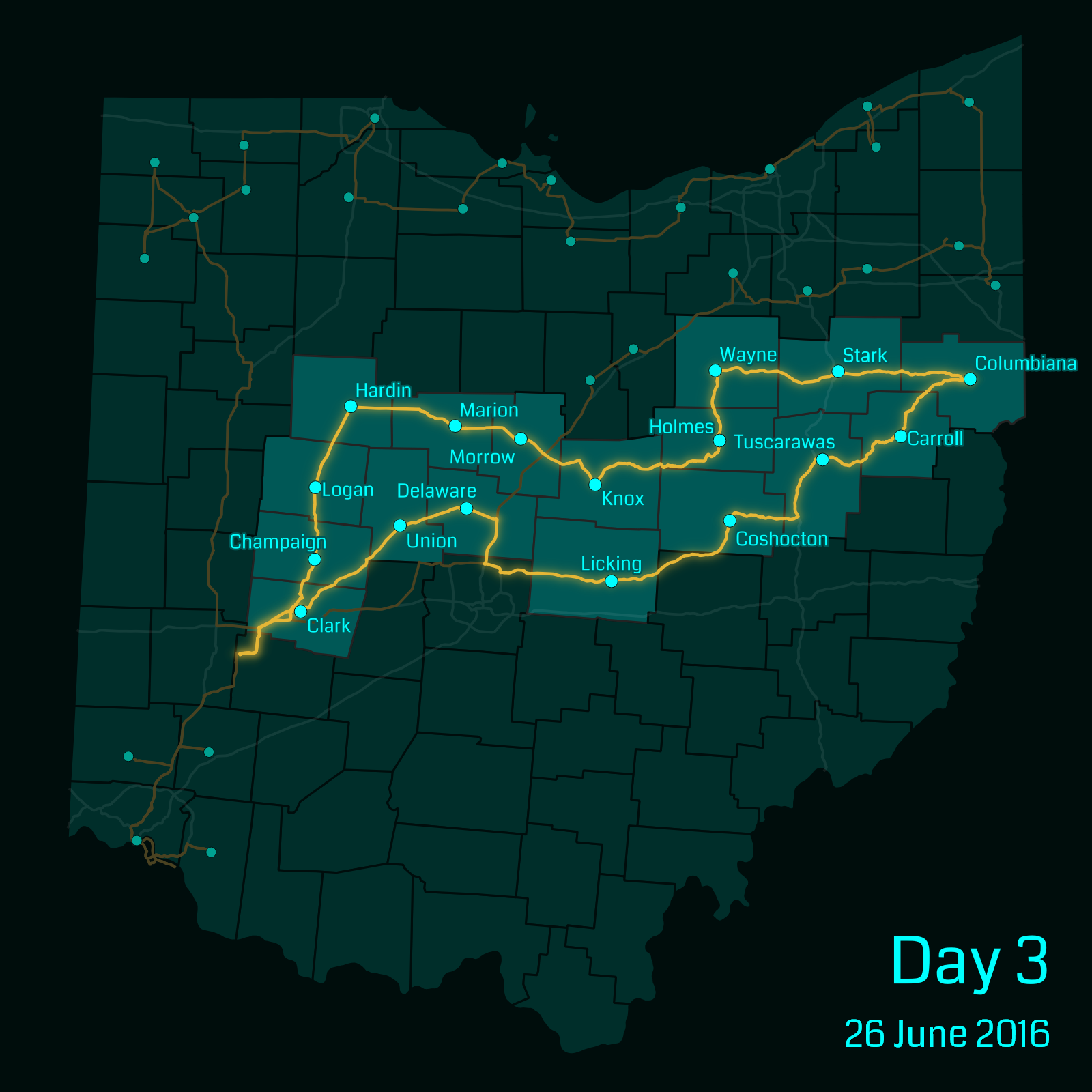
We had a free day, so we decided to try out one of the longer missions. We saw online that there was a small festival occurring in Columbiana county that day, so we decided we’d leave early in the morning, stop at the festival for a late lunch, and continue on back home.
As we approached Columbiana county, though, Amy had been looking for more information on the festival while I’d been driving. She discovered that it was less of a festival and more of a social hosted by a local church—with lunch served at a specific time that had already passed. We decided we’d just get lunch at a restaurant instead, and ended up at the Court House Inn & Restaurant. The food was pretty good, and it had one of the oddest restrooms I’ve ever seen.
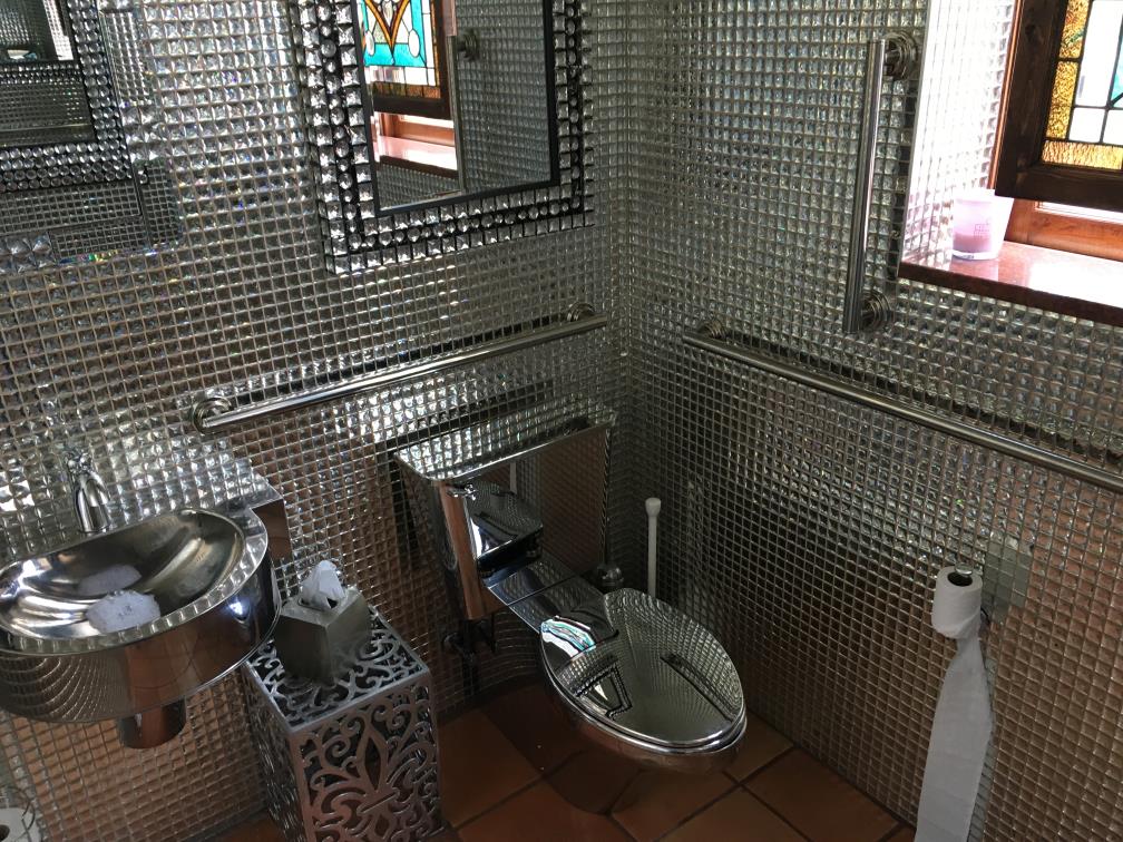
Amy said that it felt like going to the bathroom inside a chandelier.
We continued the mission, and things were relatively uneventful until we started heading west between Morrow and Hardin counties. Apparently, there had been substantial rainfall in the area over the prior week, and there was a good amount of flooding going on in the area. Fortunately, although there were points where one lane was covered in water, our road was never completely flooded.
We got past all the flooding, and ended up hitting the last portal while the sun was still up. My mission day length planning had been successful.
Day Four: Montgomery County to Miami County
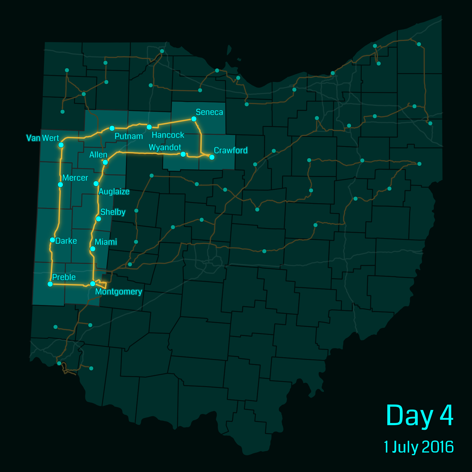
Yet again, we looked up festivals in the state, and found an antique tractor festival in Van Wert. I couldn’t say I’d ever been to such a festival before, so we figured it was as good a reason as any to select the mission day that included Van Wert.
Unfortunately, US-127 was under construction just outside the Van Wert fairgrounds, forcing us to do a bit of a detour. When we were done with the festival, we tried to get lunch, and the restaurant we were trying to get to was on the closed section of road. They did have a sign posted under “ROAD CLOSED” stating that the road was open to local businesses, with our restaurant specifically listed, so we followed the signs, along with several other cars—right through the middle of an active construction site. It really felt like the project wasn’t planned properly to allow business access during construction, so they just let traffic come through at its own risk.
The day became relatively easy after that. Once we completed Crawford county, the remainder of the trip used US-30 and I-75—both freeways—substantially speeding things up.
Day Five: Ross County to Greene County
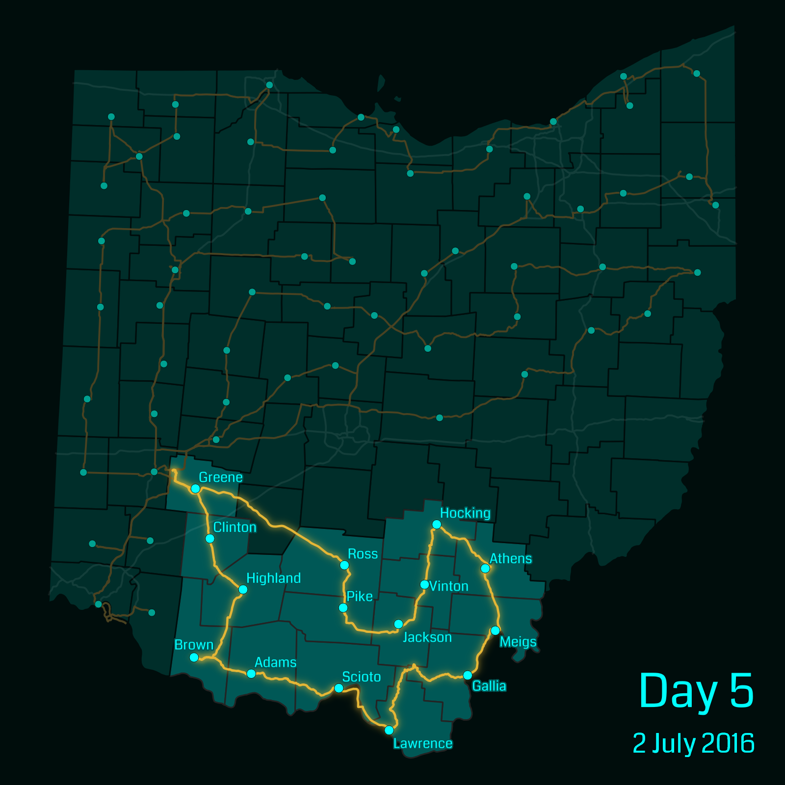
I’ve not spent much time in the southern part of the state, which includes rural foothills of the Appalachian mountains. As such, although the distance wasn’t too great, it ended up being one of my longer mission days, since much of the travel was on curvy mountain roads.
At one point between the Gallia and Lawrence county courthouses, one of the roads we were meant to take was closed, and we began to follow the detour signs instead. However, after a while, the detour signs disappeared. I don’t know if they were missing, or if we’d missed a turn, but we ended up having the GPS find us a detour instead… which ended up being fifteen miles of gravel back roads.
We ended up stopping for dinner in Scioto county, and by the time we left it was getting dark. We didn’t end up getting home until slightly after midnight.
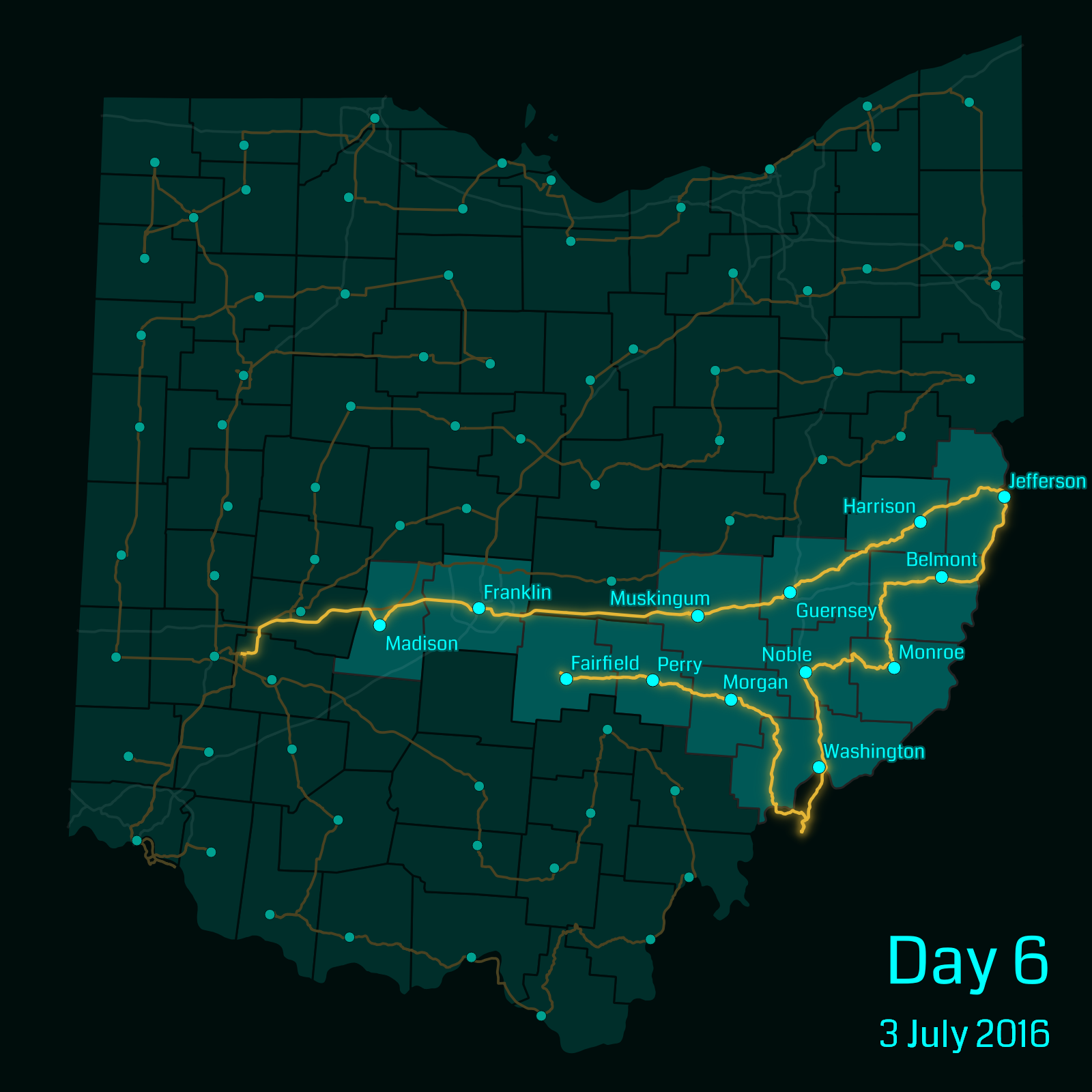
Day Six: Madison County to Fairfield County
At this point, we only had one mission day left. However, we weren’t able to leave until later in the morning, and we were able to find an inexpensive hotel in Lancaster (Fairfield county), so we decided to do most of the remaining portals in one day and get a hotel for the night.
Day Seven: Pickaway County and Fayette County
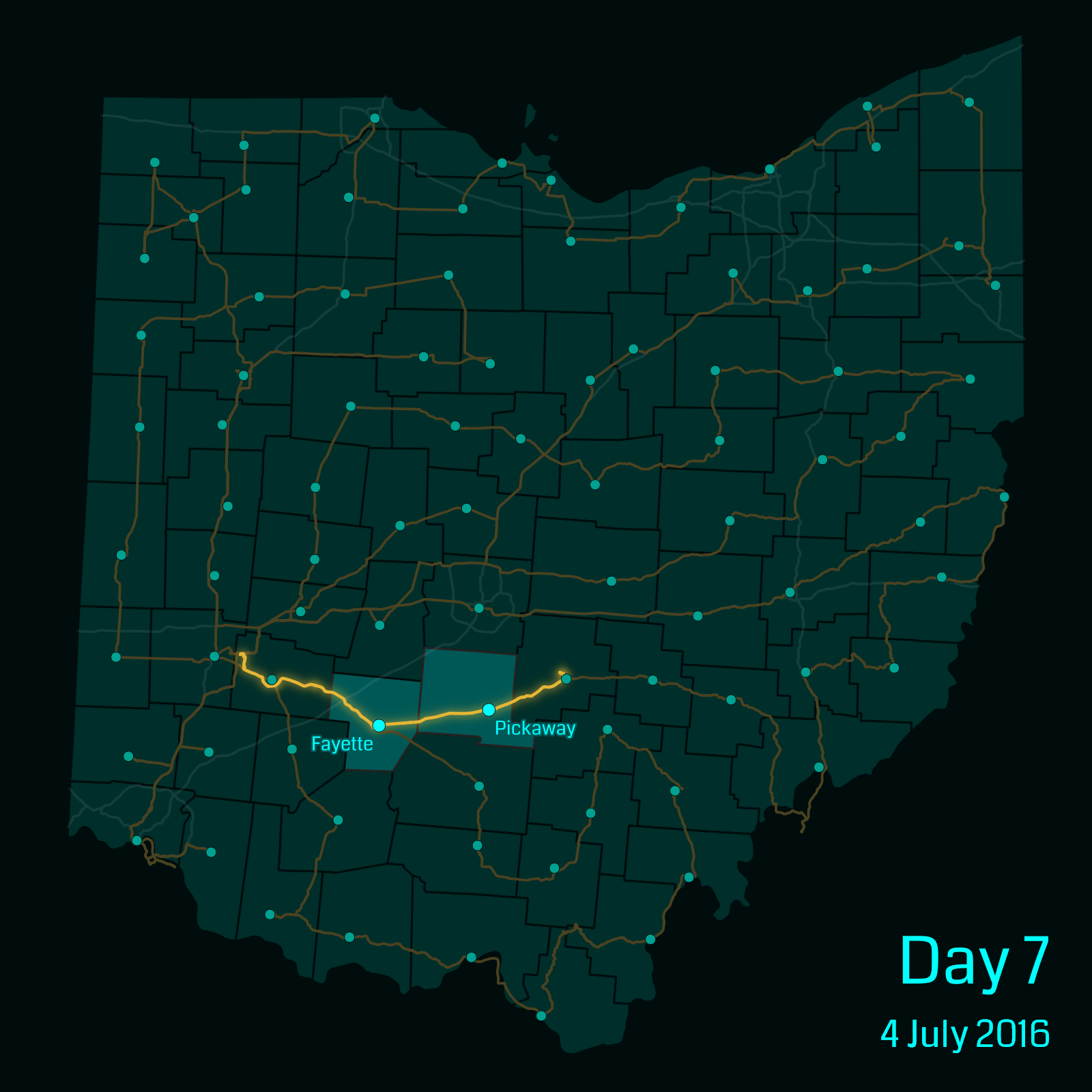
For the easiest day of all, we only had two portals remaining. So as a fitting end to the mission, I somehow ended up getting Ingress speed locked1 going into Fayette county, and had to wait around fifteen minutes before I could interact with the final portal.
The seat of Fayette County is the city of Washington Court House, Ohio, which means that my final waypoint was the Washington Court House courthouse.
Completion
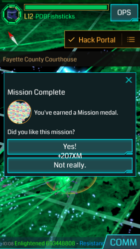
Eight days later, and I had completed what was by far my longest mission. It was exhausting at times, but in the end, it was nice to be the first two people to complete the mission.
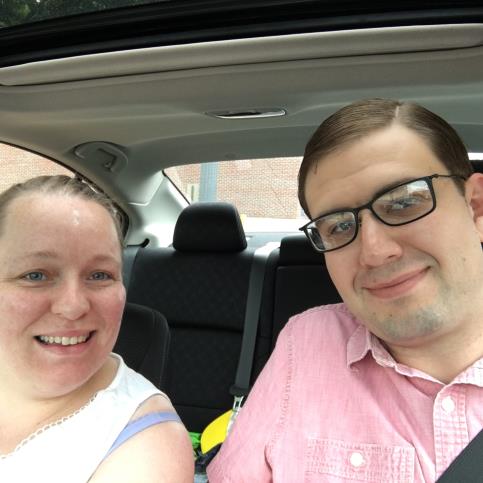
Amy and I, parked in front of the final courthouse as we completed the mission.
-
To prevent using Ingress from a moving car, the game will prevent interaction with portals (waypoints) if the ratio of time between their interactions to distance between them is too low. However, it can sometimes glitch, and the only remedy is to wait fifteen minutes for the restriction to disappear. ↩︎