Flight Log Version 1.3: Distances and Annual Summaries
I’ve updated my Flight Log to version 1.3 by adding distances to flights, and by adding more statistics to the annual summary pages.
Distances
The home page now shows the total distance flown across all flights. (I’ve used the great circle distance between the airports for every flight’s distance, rather than the actual flight route flown. This is the way that most U.S. airlines calculate mileage.)
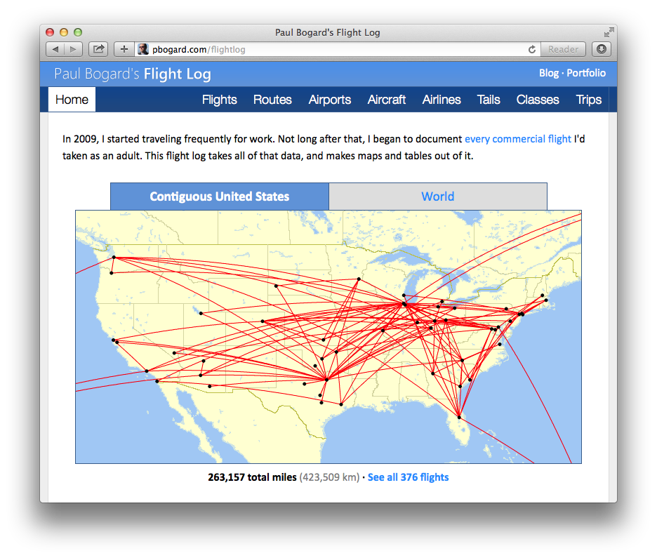
Map generated by Paul Bogard using the Great Circle Mapper - copyright © Karl L. Swartz
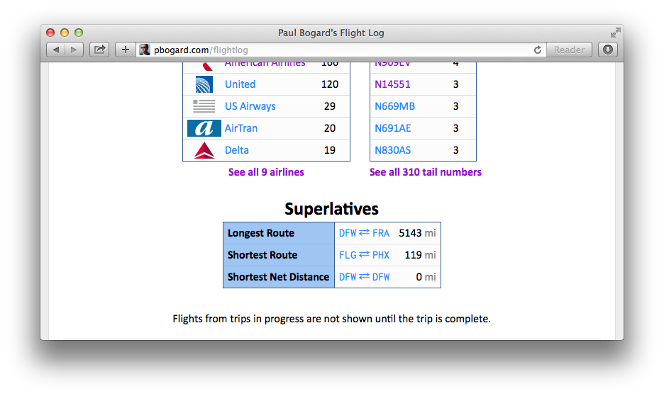
At the bottom of the page, I’ve added the longest route, shortest route (for routes that actually have a distance), and shortest net distance (for routes where the origin is the same as the departure, and thus the net distance traveled is zero).
The total distance flown has been added for every flight, route, aircraft family, airline, operator, tail, fleet number, travel class, trip, and trip section.
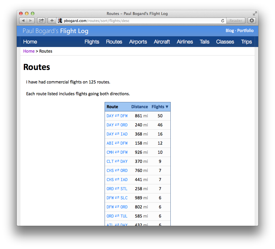
The Routes page now shows the great circle distance for each route. In addition, the page can now be sorted by either distance or number of flights.
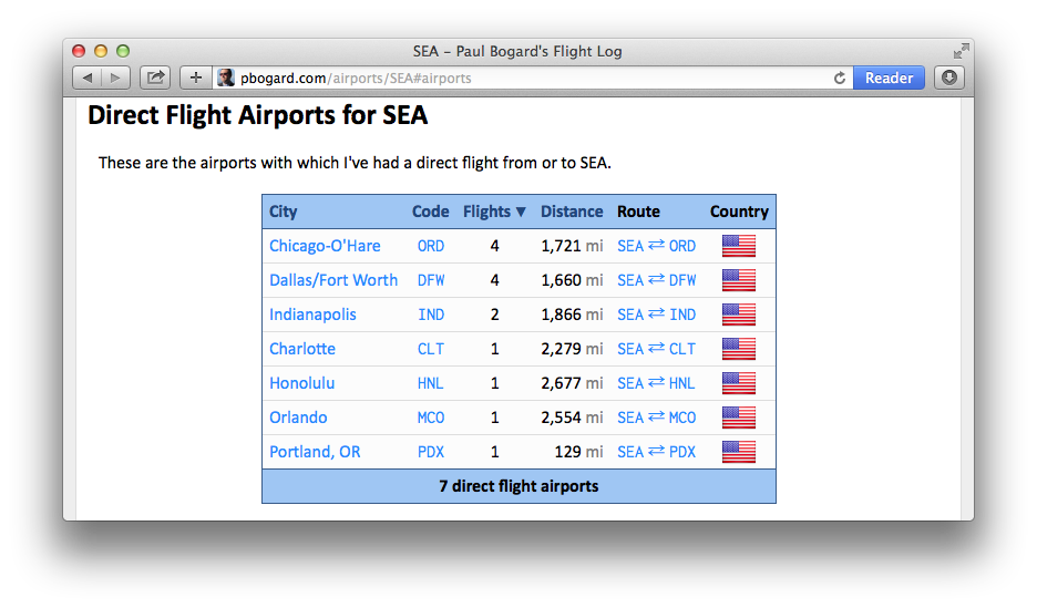
I’ve done the same thing on the show airport page, showing the distance to each of the direct flight airports. This table, too, is sortable.
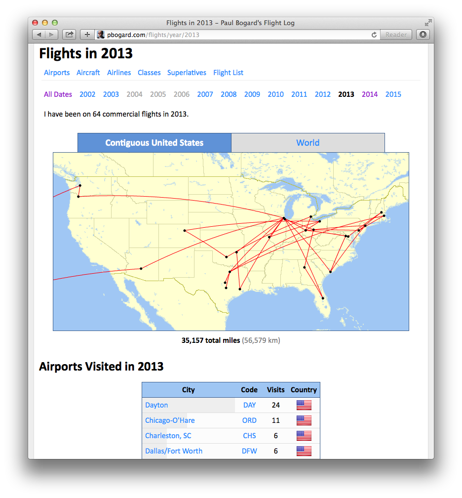
Annual Summary Pages
At the top of the index flights page, there have been links to years. Clicking on one of them brings me to an annual summary page, showing a map and table of all of the flights in that year. I’ve now added more details to this page:
- The year’s airports visited
- The year’s aircraft families flown
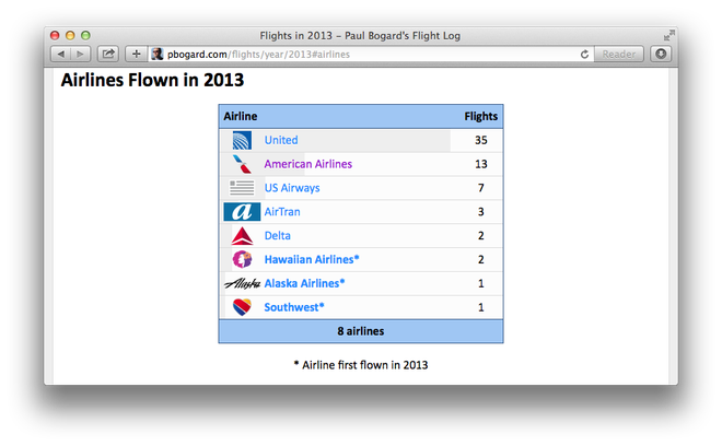
- The year’s airlines flown
- The year’s classes flown
- The year’s longest and shortest routes
Map generated by Paul Bogard using the Great Circle Mapper - copyright © Karl L. Swartz
Airports that were first visited in the year, aircraft families that were first flown in the year, and airlines that were first used in the year are noted in their respective tables.
Changelog
New
- Added more details to Show Flights by Year (annual summary) view.
- Added distances to flights.
Changed
- Minor improvements to New Flight and Edit Flight forms.