Chicago Midway International Airport
Chicago, Illinois, United States
First visited 6 December 2013
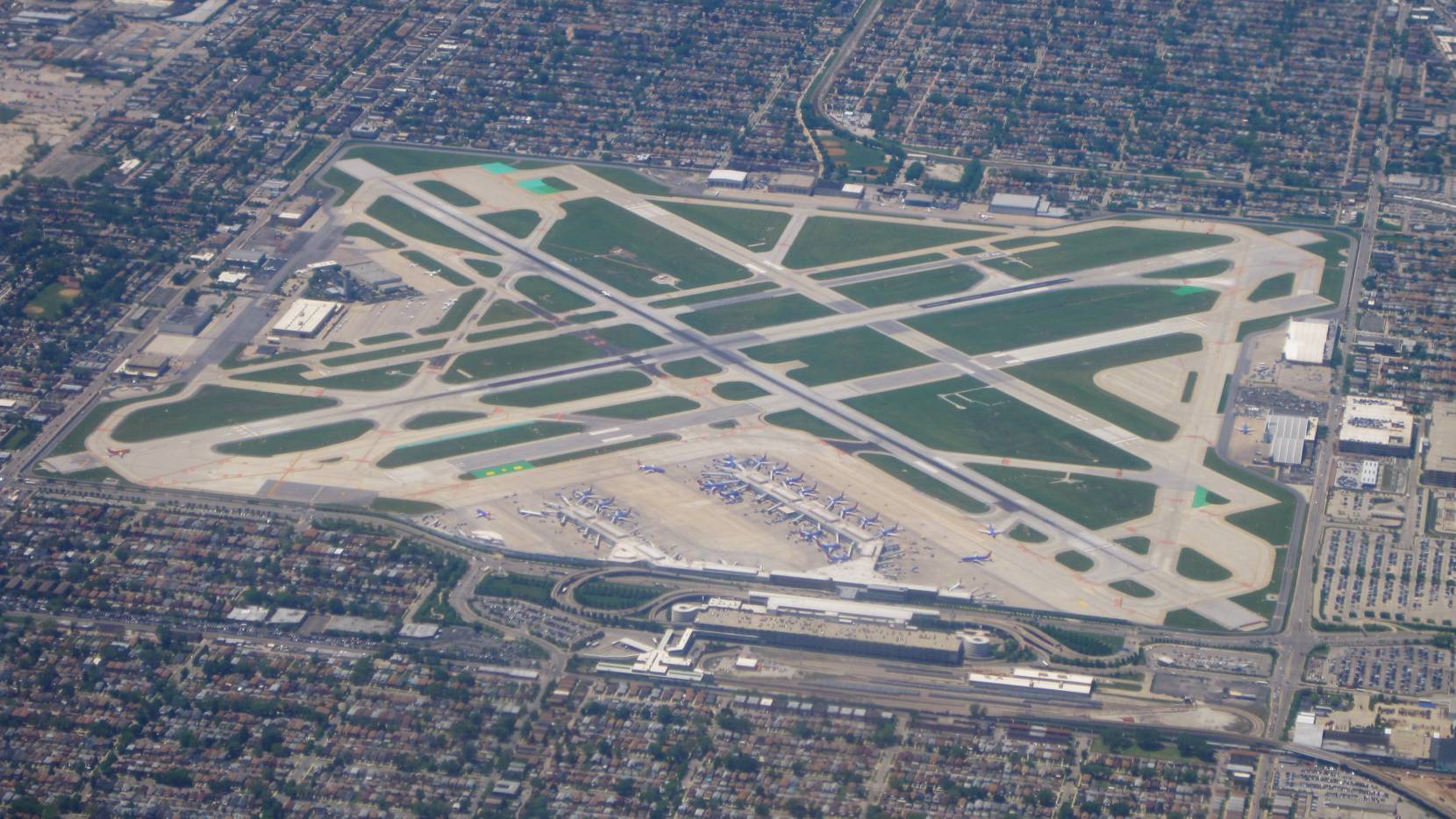
While I have no particularly strong opinions about the Chicago Midway terminal, I love the concept of Midway’s airfield. Chicago’s major streets near MDW generally form a one mile grid, and so MDW was squeezed into just about a single square mile (very slightly larger, since Cicero Avenue jogs just a bit to the east to make a little more room for the terminal).
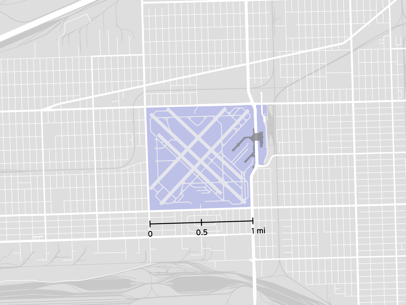
MDW in a one mile square.
Map data © OpenStreetMap contributors
It’s a very recognizable airport from the air, and I can often see it out the window when I’m flying into O’Hare from the southeast.