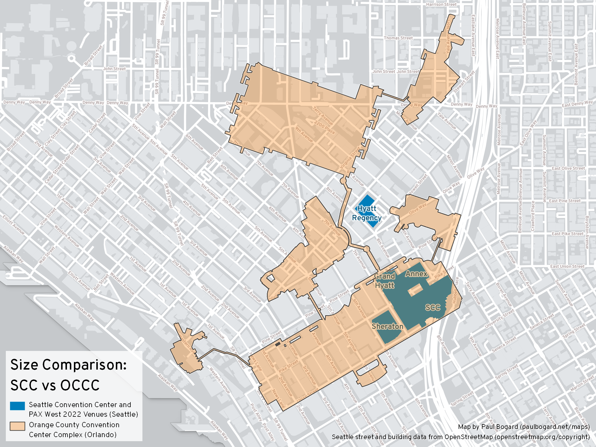
My two most-visited convention centers are the Seattle Convention Center (Seattle, Washington) and the Orange County Convention Center (Orlando, Florida); both have events that I attend nearly every year.
With the SCC being located in a dense city, it’s very compact, spreading over only a few city blocks (although it makes good use of vertical space). The OCCC, on the other hand, is an enormous, sprawling convention center. I was curious just how big it was relative to the SCC, so I created this map as a size comparison. Since SCC events often spill into neighboring hotels and event venues, I highlighted all of the venues that PAX West 2022 used in addition to the SCC itself.

From this map, we can see just how large the OCCC is. With the eastern edge of the OCCC West Building lined up over the SCC, the west edge stretches almost all the way down to Pike Place market, while the OCCC’s North/South building extends past Denny Way.

Building layout of the Orange County Convention Center complex
Technical Details
To create this map, I exported my SVG OCCC silhouette to a PNG raster image. With QGIS, I used the Georeferencer tool to add location data to the raster, then converted it back to a vector polygon with the Polygonize tool. Finally, I created a print layout with two maps using an Albers equal area projection at the same scale: Seattle (with street and building data) on the bottom, and Orlando (with just the OCCC polygon and no background) on top. The OCCC map is rotated to align roughly with the Seattle street grid.

