Ten years ago, I published 2013 Year in Travel—my first ever annual travel summary. Though it was little more than some flight and status data, each year since then I’ve improved upon the format. I’m happy this series is celebrating its tenth anniversary!
I spent slightly less time traveling this year compared to last year. For the first time in several years, I did end up traveling internationally: an Iceland honeymoon in January, and Japan in April and May.
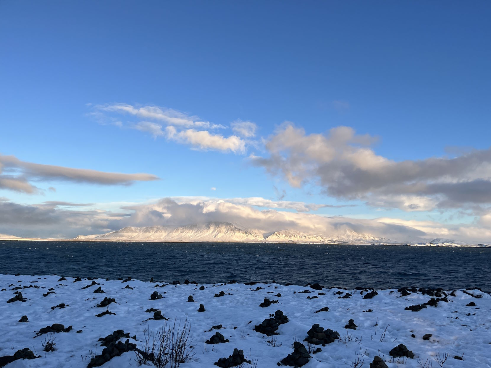
Kollafjörður Bay near Reykjavík, Iceland
Table of Contents
Hotel Nights
I stayed away from home 87 nights in 2023.

Nights Away from Home by Year. Includes both business and personal nights.
My work travel schedule wasn’t quite as busy in 2023, and my number of nights away from home went down. However, my personal travel nights did increase slightly, as I cashed in some hotel points for trips to Iceland, Michigan, and Texas.
Hotel Maps
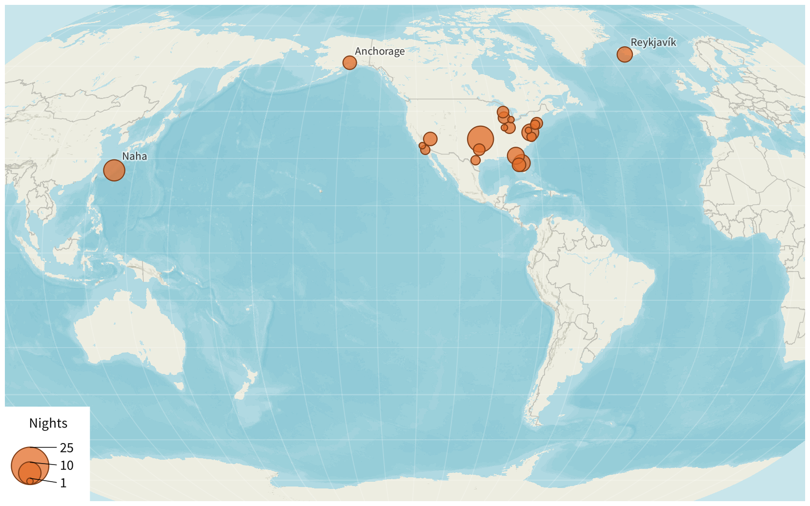
Nights Away From Home (2023). Metropolitan areas where I spent the night. (Nights spent on an overnight flight are not shown.)
Basemap © Mapbox © OpenStreetMap (Improve this map)
I visited both Iceland and Japan. Oddly enough, the last time I visited Japan (in 2019), I also visited Iceland in the same year.
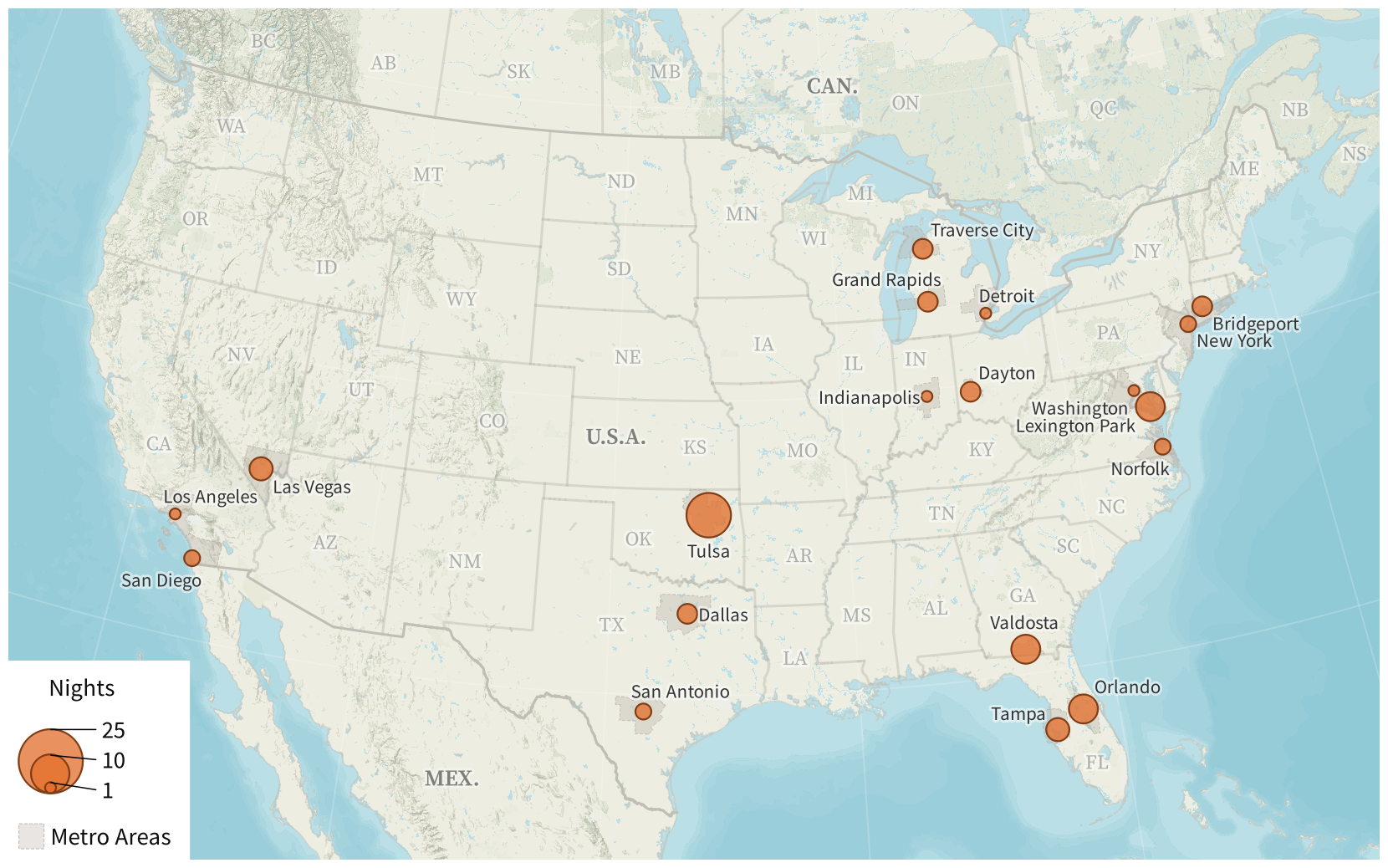
Nights Away From Home (Contiguous United States, 2023). Metropolitan areas where I spent the night.
Basemap © Mapbox © OpenStreetMap (Improve this map)
My 2023 metro areas with the most nights were Tulsa, Oklahoma (13 nights across 3 trips) and Naha, Okinawa, Japan (9 nights on a single trip). This was the first time I’d visited Naha.

Naha
Due to home repairs, I spent three nights at a hotel near my home in the Dayton metro area. This was also the second time we had our cat in a hotel; the first was back in 2020.
In addition to hotel stays, I spent three nights on overnight flights (which are included in the nights away from home totals above):
| Flight | Route | Morning of |
|---|---|---|
| Icelandair 644 | Washington to Reykjavík | 6 January |
| Japan Airlines 11 | Dallas to Tokyo | 22 April |
| Delta 738 | Seattle to Atlanta | 12 August |
Distance from Home by Day

Distance from Home (2023). How far away from home I was on every day of the year.
Naha, Japan, was my farthest destination this year, at 7457 mi (12 001 km) from my home near Dayton, Ohio. Anchorage, Alaska, (3090 mi or 4972 km away) was second, being surprisingly slightly farther from home than Reykjavík, Iceland (2974 mi or 4786 km away).1
Flights
I flew on 67 flights flights this year, with a total distance of 58 791 mi (94 614 km).

Number of Flights by Year. Includes both business and personal flights.

Distance Flown by Year. Includes both business and personal flights.
Although the number of flights I took this year slightly decreased, the trips I took outside of the contiguous United States (OCONUS) meant my distance flown actually went up substantially—last year, I only flew 36 776 miles (59 185 km).
Flight Maps
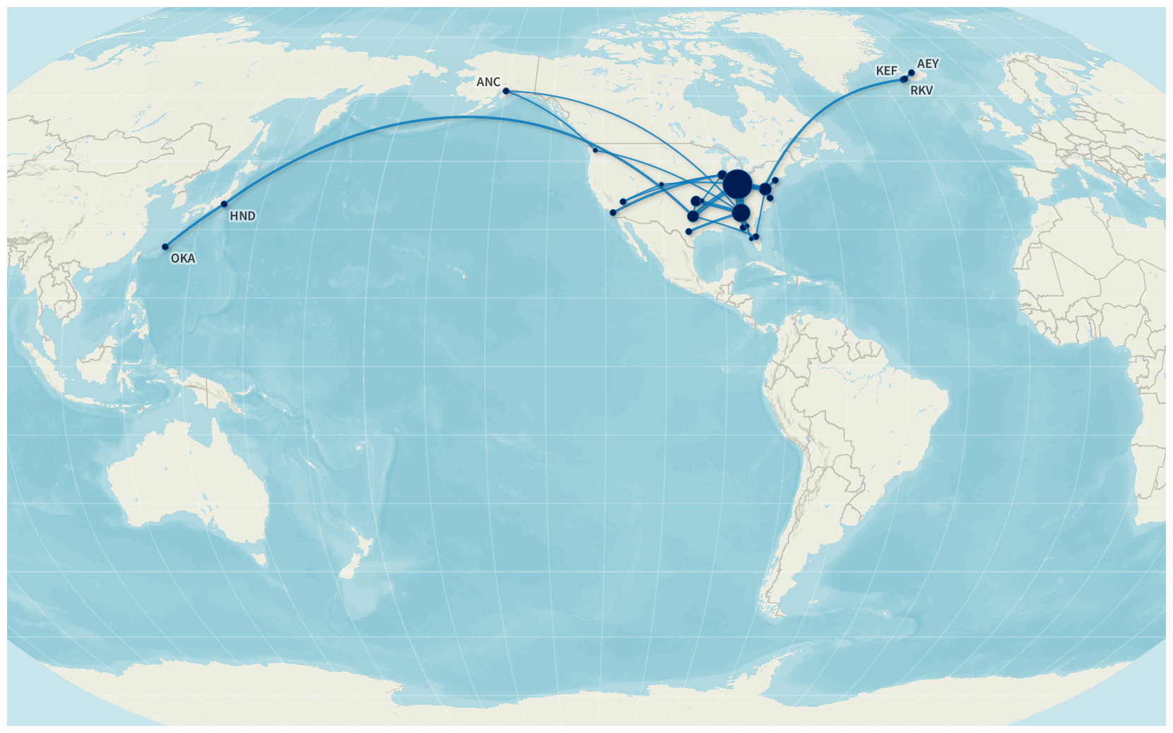
Flights (2023). Flight data details are on Flight Historian.
Basemap © Mapbox © OpenStreetMap (Improve this map)
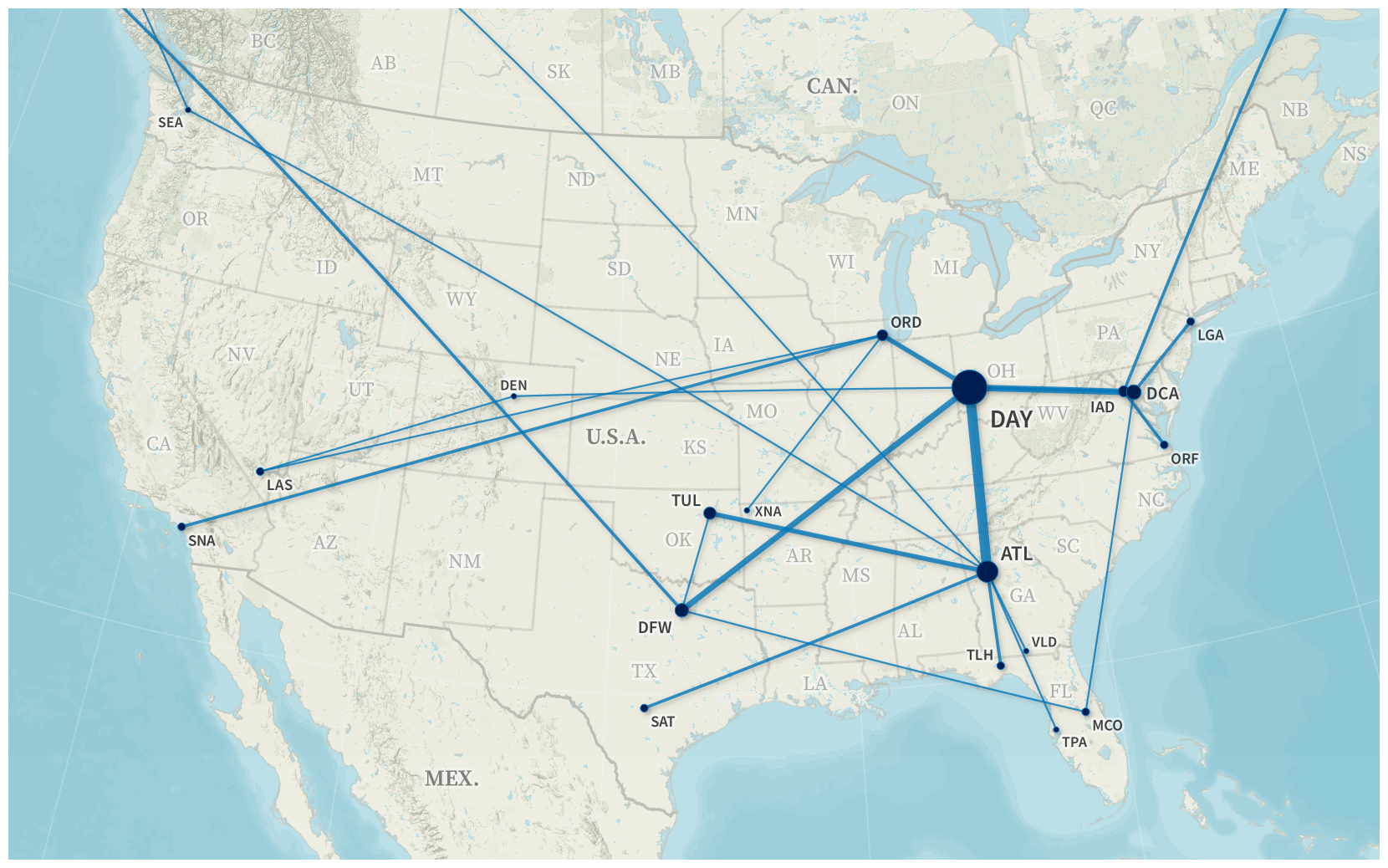
Flights (Contiguous United States, 2023). Flight data details are on Flight Historian.
Basemap © Mapbox © OpenStreetMap (Improve this map)
My trips were pretty evenly distributed this year. I visited Tulsa and Valdosta three times each, and nowhere else more than twice. (Compare that to 2018, when I had 16 separate trips to Altus, Oklahoma!) My routes from Dayton (DAY) to the hubs that serve it were busy, but most of my other flight routes weren’t flown more than a few times each.
Even Tulsa and Valdosta were varied on routes. For one of my Tulsa trips, I couldn’t get a flight into TUL on the right date, and ended up having to fly into Northwest Arkansas (XNA) instead.

A small bird says things are bueno in Tulsa
Valdosta is just a pain to get to. It has a small airport (VLD), but it’s hard to get flights and rental cars there. I only used its airport on a multi-city trip where I flew into Tampa (TPA) for a meeting, drove up to Valdosta for another meeting, and flew home from there. On other Valdosta trips, I just flew into and out of Atlanta (ATL) or Tallahassee (TLH) and drove a few hours each way.
Flight Graph

Flights by Airline (2023). Each circle represents an airport, and each arrow represents a flight from one airport to another.
The majority of my 2023 flights were on Delta and American Airlines. As is typical, nearly all of my Delta flights connected through Atlanta (ATL). My only exception was one Anchorage (ANC) to Seattle (SEA) flight which then connected on through Atlanta.

Fed C. Bat: my Roy G. Biv-type mnemonic for the terminals at Atlanta (ATL).
My American flights were a little more varied, but mostly involved Washington–Reagan National (DCA) or Dallas/Fort Worth (DFW). Several times DCA itself was a destination, as it’s the closest airport for my trips to southern Maryland.
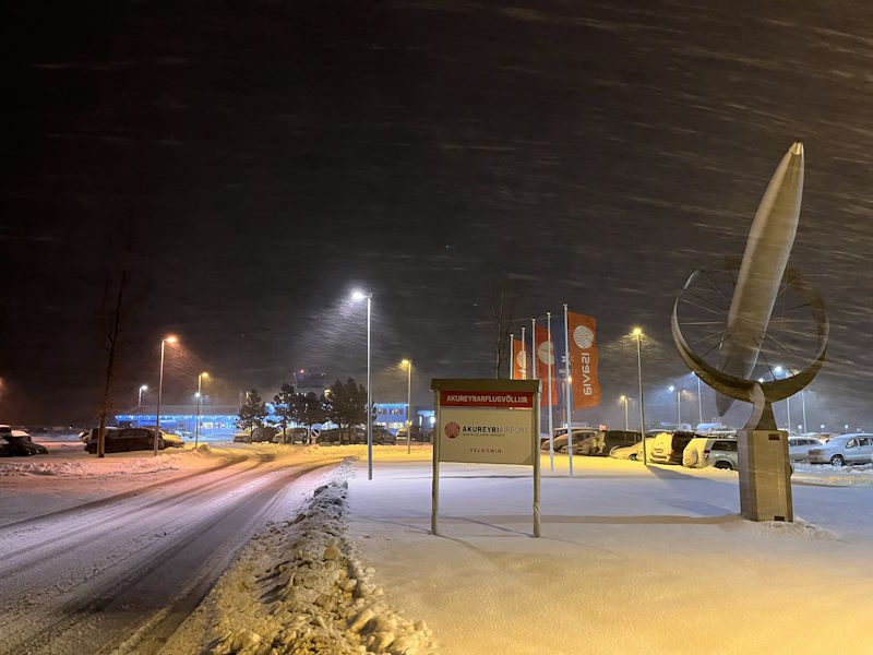
Reykjavík uses separate airports for international (KEF) and domestic (RKV) flights. On this year’s Iceland vacation, though we were staying in Reykjavík, my wife and I took a day trip up to northern Iceland. Our same-day round trip flight between Reykjavík’s domestic airport and Akureyri (AEY) meant I ended up with two disconnected flight networks this year—one network entirely between RKV and AEY, and one network for everything else.
New Airports
This year, I flew through 10 airports that I’d never flown through before. With these, I’ve now had flights at 112 different airports.
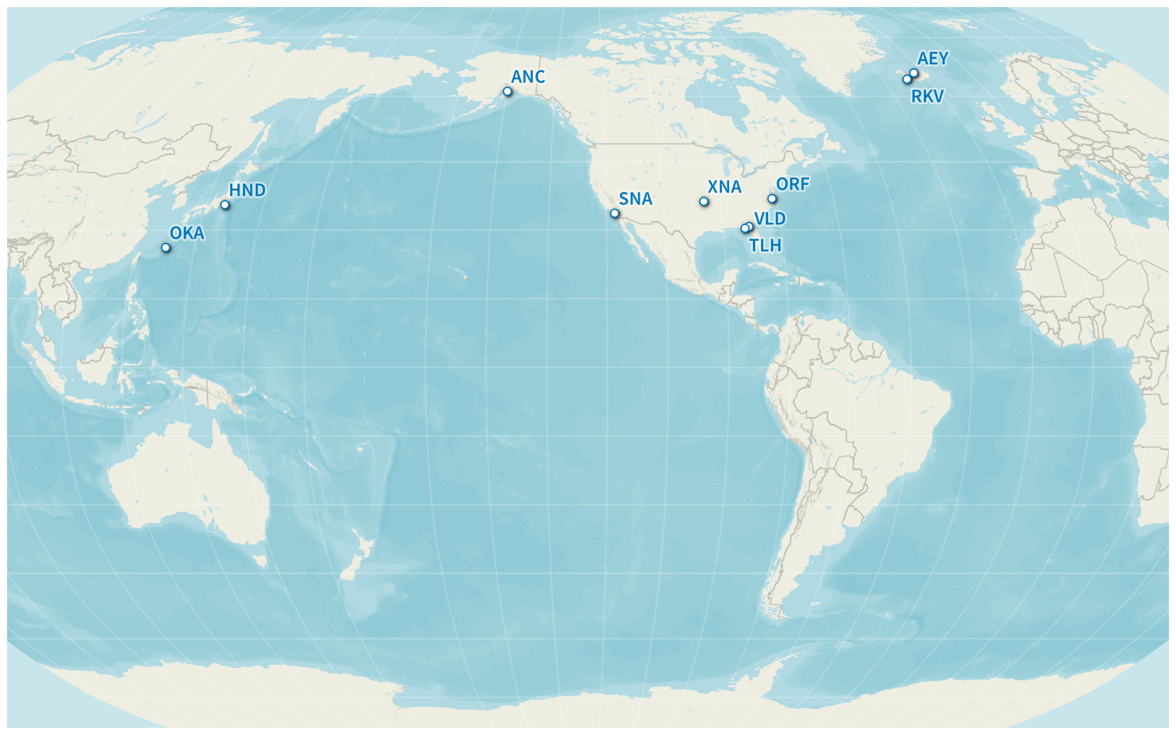
New Airports (2023). Flight data details are on Flight Historian.
Basemap © Mapbox © OpenStreetMap (Improve this map)
| # | Code | Airport | First Visit |
|---|---|---|---|
| 107 | RKV |
Iceland
|
8 Jan 2023 |
| 108 | AEY |
Iceland
|
8 Jan 2023 |
| 109 | XNA |
Arkansas,
United States
|
20 Feb 2023 |
| 110 | VLD |
Georgia,
United States
|
2 Mar 2023 |
| 111 | SNA |
California,
United States
|
27 Mar 2023 |
| 112 | HND |
Japan
|
22 Apr 2023 |
| 113 | OKA |
Japan
|
22 Apr 2023 |
| 114 | TLH |
Florida,
United States
|
28 Jun 2023 |
| 115 | ANC |
Alaska,
United States
|
7 Aug 2023 |
| 116 | ORF |
Virginia,
United States
|
20 Sep 2023 |
While I’d been to Iceland before, I’d only used the international airport at Reykjavík–Keflavík (KEF). Both Reykjavík–Domestic (RKV) and Akureyri (AEY) were new to me. AEY is also the northernmost airport I’ve visited to date.
Similarly, while I’d already been to Tokyo, I’d only previously flown into Tokyo–Narita (NRT). For this year’s trip, Tokyo was only a layover on my way to Okinawa, so I cleared customs at Tokyo-Haneda (HND) and then connected on to a flight to Naha (OKA), and then connected through HND again on my way home.
I got a number of new domestic U.S. airports. Anchorage (ANC) was my only truly new domestic destination this year; the rest of the airports were alternate airports for destinations I’d already been to.
New Airlines
Though my Naha, Japan, trip was booked through American Airlines, three of the six flights were operated by their alliance partner, Japan Airlines. My Dallas/Fort Worth (DFW) to Tokyo-Haneda (HND) 14 hour transpacific flight was my very first JAL flight, and I was able to buy a last minute upgrade to premium economy at the gate for a very reasonable price. My other two JAL flights, from HND to Naha (OKA) and back, were in economy, but it was still a very pleasant economy experience.
New Aircraft

Airbus A350 (Japan Airlines)
Aircraft illustration by Norebbo
The third of my JAL flights this year (from OKA to HND) was on an Airbus A350-900, which was the first time I’d flown on any variant of the A350.

JAL even had Airbus A350 postcards available. All of their aircraft types I experienced kept them in a rack on the bulkhead; I actually picked up this postcard on a Boeing 777 flight.
Driving
I drove 29 881 miles (48 089 km) this year.

Driving Distance by Year. Includes both business and personal driving.
| Personal Cars | 23 925 mi | 38 504 km |
| Rental Cars | 5 956 mi | 9 585 km |
| Total | 29 881 mi | 48 089 km |
My driving distance was a little higher than last year, with slightly fewer rental car miles and a few thousand more personal car miles.
Driving Maps
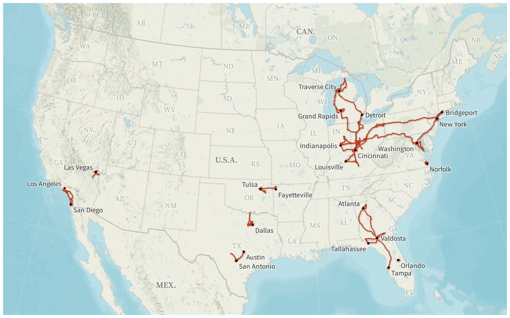
Driving (Contiguous United States, 2023)
Basemap © Mapbox © OpenStreetMap (Improve this map)
Our January Iceland honeymoon trip involved quite a bit of driving. We’d initially booked Icelandair flights from Baltimore (BWI) with the intent to drive to Baltimore and back, spending the night on either side of the flights. Those flights were cancelled and shifted to Washington–Dulles (IAD) instead. Shortly before our trip, we decided that we wanted to visit New York City and stay at the TWA Hotel at New York–Kennedy (JFK), but we weren’t able to switch the Icelandair flights from IAD to JFK. So we drove from Dayton to New York City, from New York City to Washington, and from Washington back to Dayton on that trip.
The TWA Hotel, built into the old TWA terminal at New York–JFK
We also took a week in July to drive around Michigan. Though most of the driving was around the Lower Peninsula, we crossed the Mackinac Bridge to visit a tiny portion of the Upper Peninsula at St. Ignace (and took a ferry from there to Mackinac Island). This was the first time I’d visited any part of the Upper Peninsula.

Sleeping Bear Dunes National Lakeshore, Lower Peninsula of Michigan
My various trips to Valdosta generated a lot of driving as well. As noted in the Flight Maps section above, besides the Valdosta airport itself, I also used airports in Tampa, Tallahassee, and Atlanta to get to and from Valdosta.
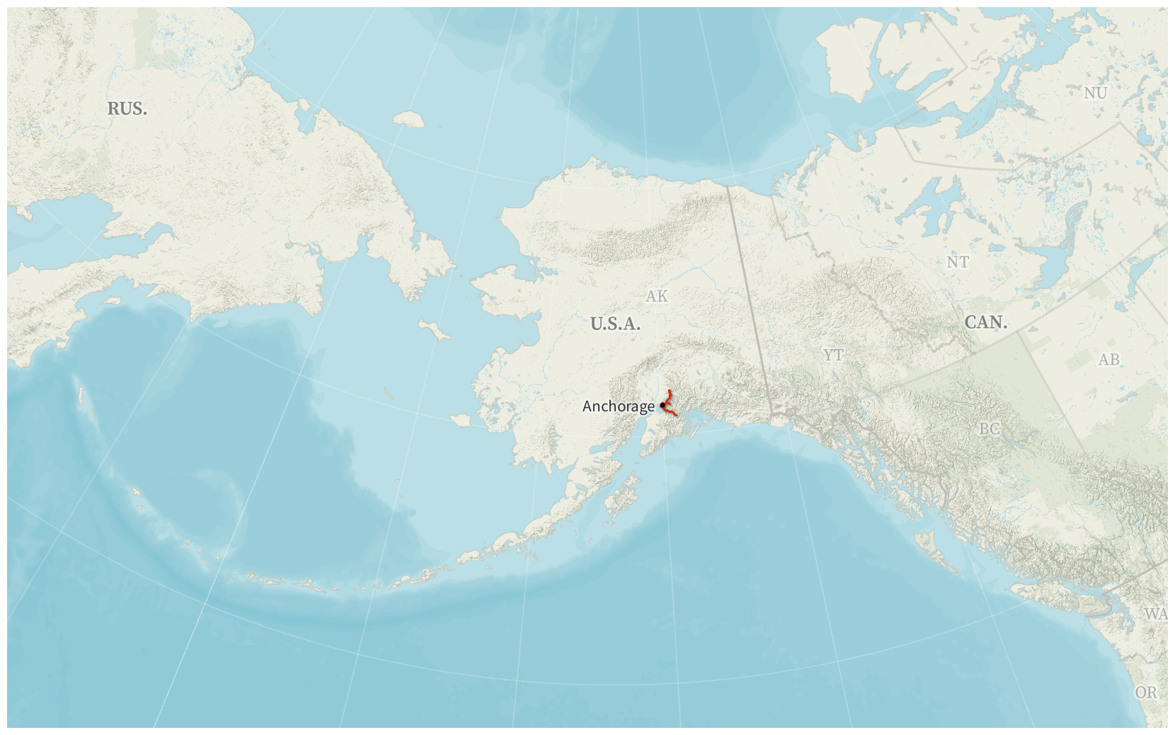
Driving (Alaska, 2023)
Basemap © Mapbox © OpenStreetMap (Improve this map)

Byron Glacier Trail near Anchorage, Alaska
All of my Alaska driving was in and around Anchorage. As it was summer in a high-latitude city, sunset didn’t occur until very late in the evening; we had plenty of daylight to go around and explore the area.
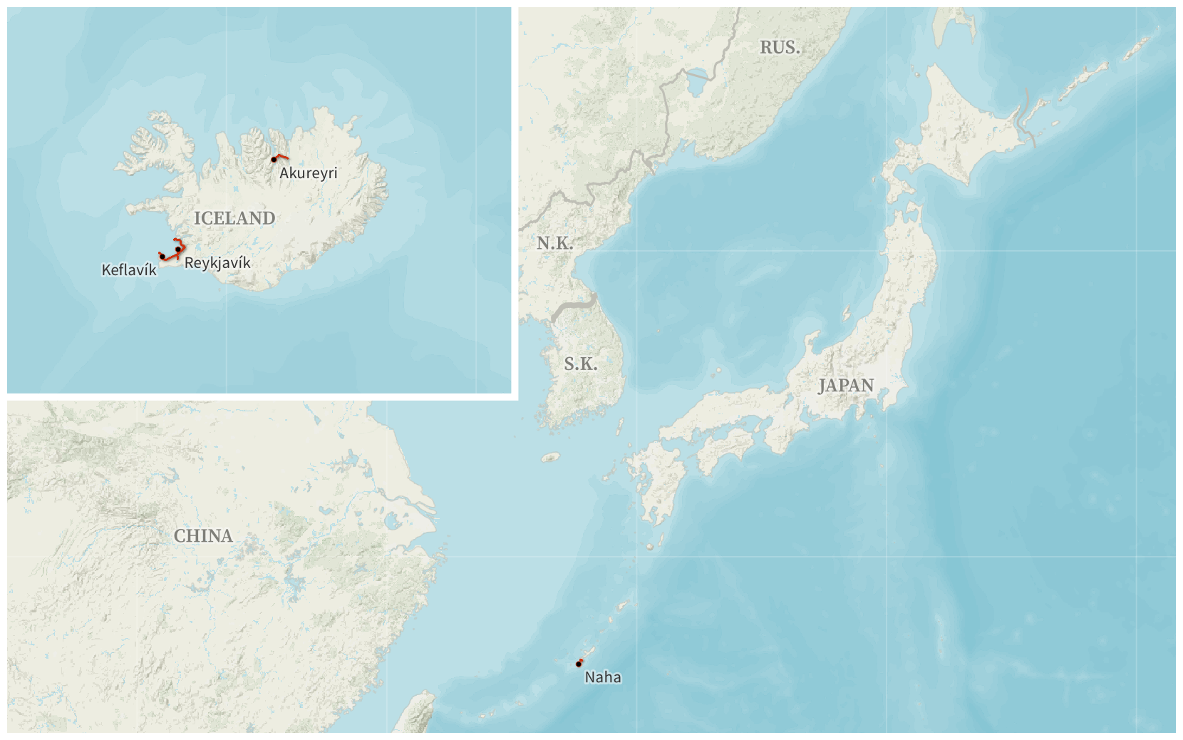
Driving (Iceland and Japan, 2023)
Basemap © Mapbox © OpenStreetMap (Improve this map)
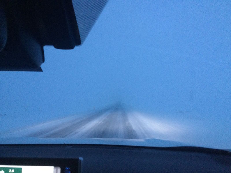
The Iceland honeymoon Amy and I took mostly involved driving around Reykjavík, but we did rent a car at the Akureyri (AEY) airport to drive around that area for the day as well. Being northern Iceland in January, the weather was not spectacular. The roads in the city were mostly fine, but once we crossed through the Vaðlaheiðargöng tunnel, the weather worsened. At some points, we were relying on staying between the reflective poles marking the road edges because we couldn’t see the road. Fortunately, we were able to turn around at the Goðafoss waterfall and make it back to Akureyri safely.
Amy and I in front of a heart-shaped traffic light in Akureyri, and the roads outside of Akureyri before conditions worsened.
My prior Japan trip was to Tokyo (where I used subways and taxis to get around), so this year’s Naha, Okinawa, trip was the first time I’ve driven in Japan. Fortunately, I’ve driven on the left before (in Australia and New Zealand), so it didn’t end up being too difficult—I only accidentally started the wipers when trying to use the turn signal a few times. 😅
I did end up getting a second, very unusual rental car one evening while there: a street-legal go-kart.2
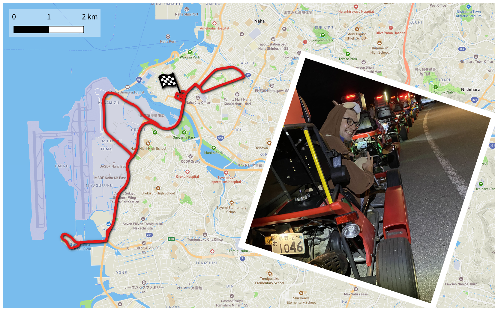
Street Kart Okinawa Route. A group of us decided to do an evening ride with Street Kart Okinawa, where they have you dress up in costumes and let you drive on city streets—in this case, a 13.4 mile (21.5 km) circuit within the city of Naha.
Basemap © Mapbox © OpenStreetMap (Improve this map)
Visited States and Countries
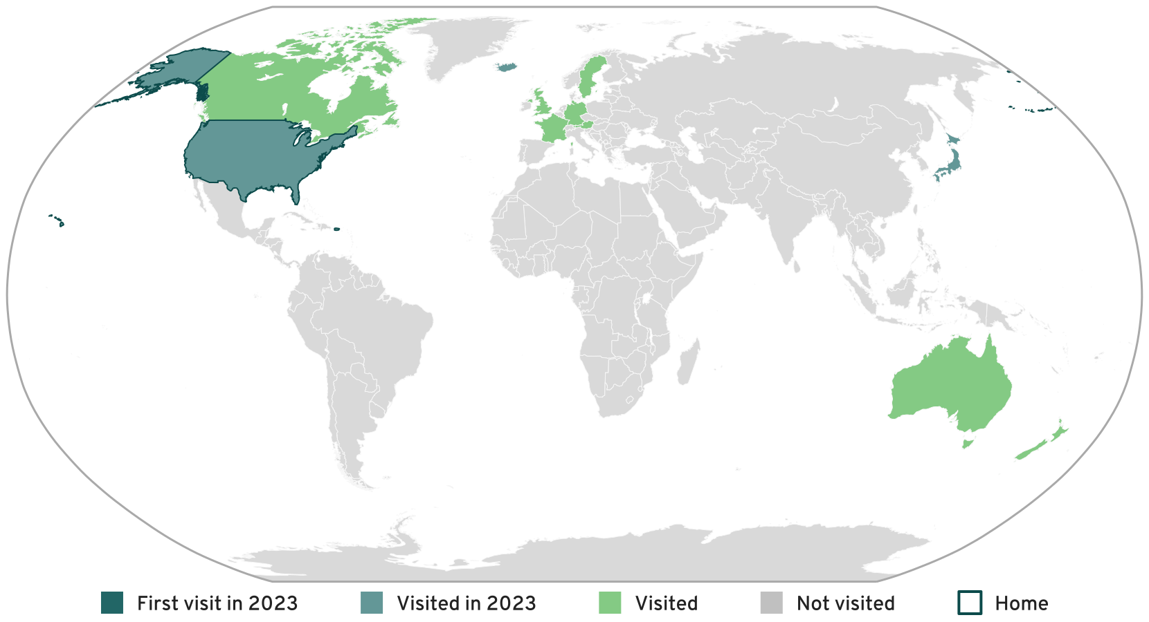
Visited Countries
I visited Iceland and Japan, both of which I’ve previously visited, so I had no new countries visited this year.
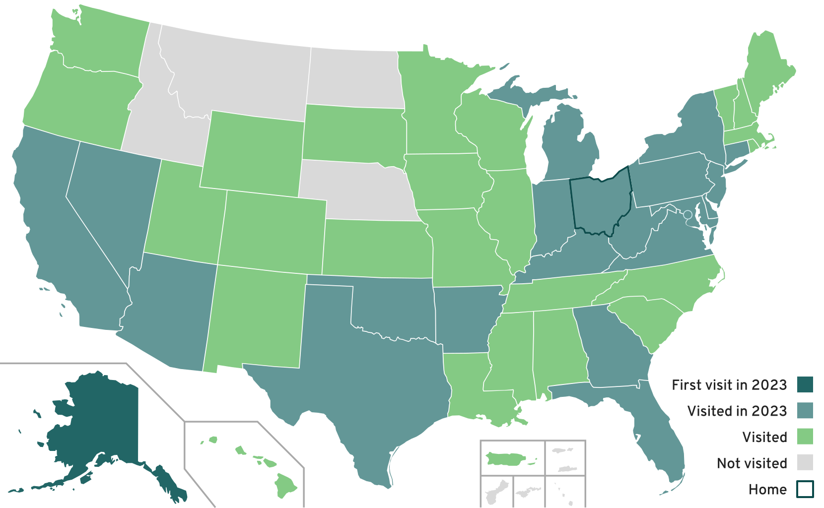
Visited U.S. States and Territories
I visited 21 states this year, plus the District of Columbia. I had my first visit to Alaska, leaving only four states I haven’t yet visited—Idaho, Montana, Nebraska, and North Dakota.
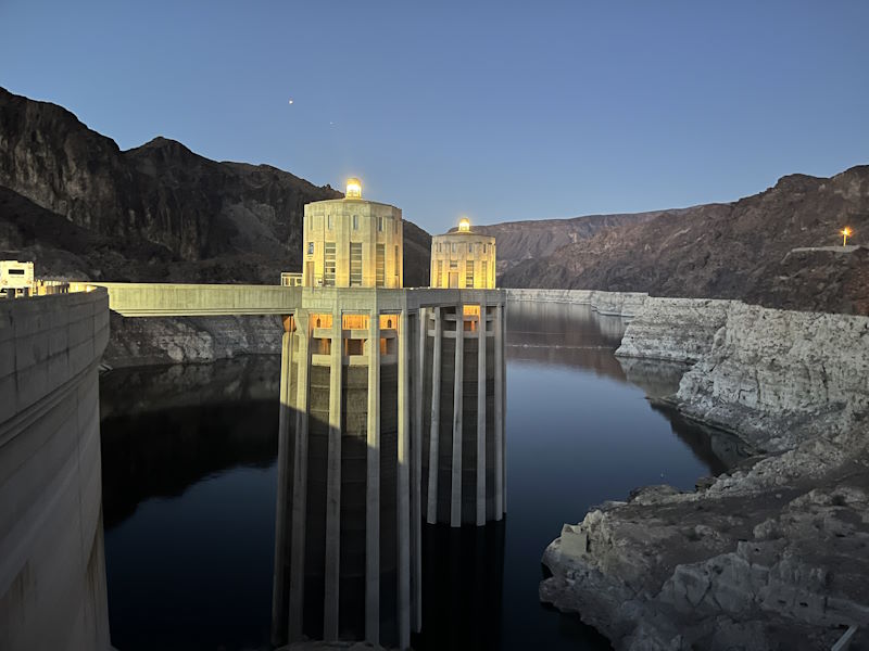
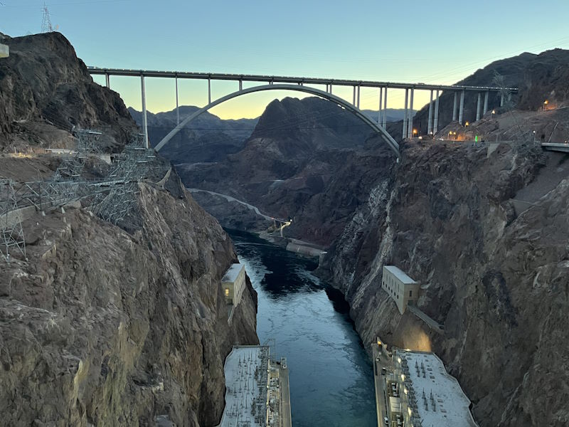
I only just barely visited Arizona; on a Las Vegas trip, I stopped at the Hoover Dam, which straddles the Nevada/Arizona border.
The Hoover Dam and the adjacent Mike O’Callaghan–Pat Tillman Memorial Bridge
Frequent Traveler Status
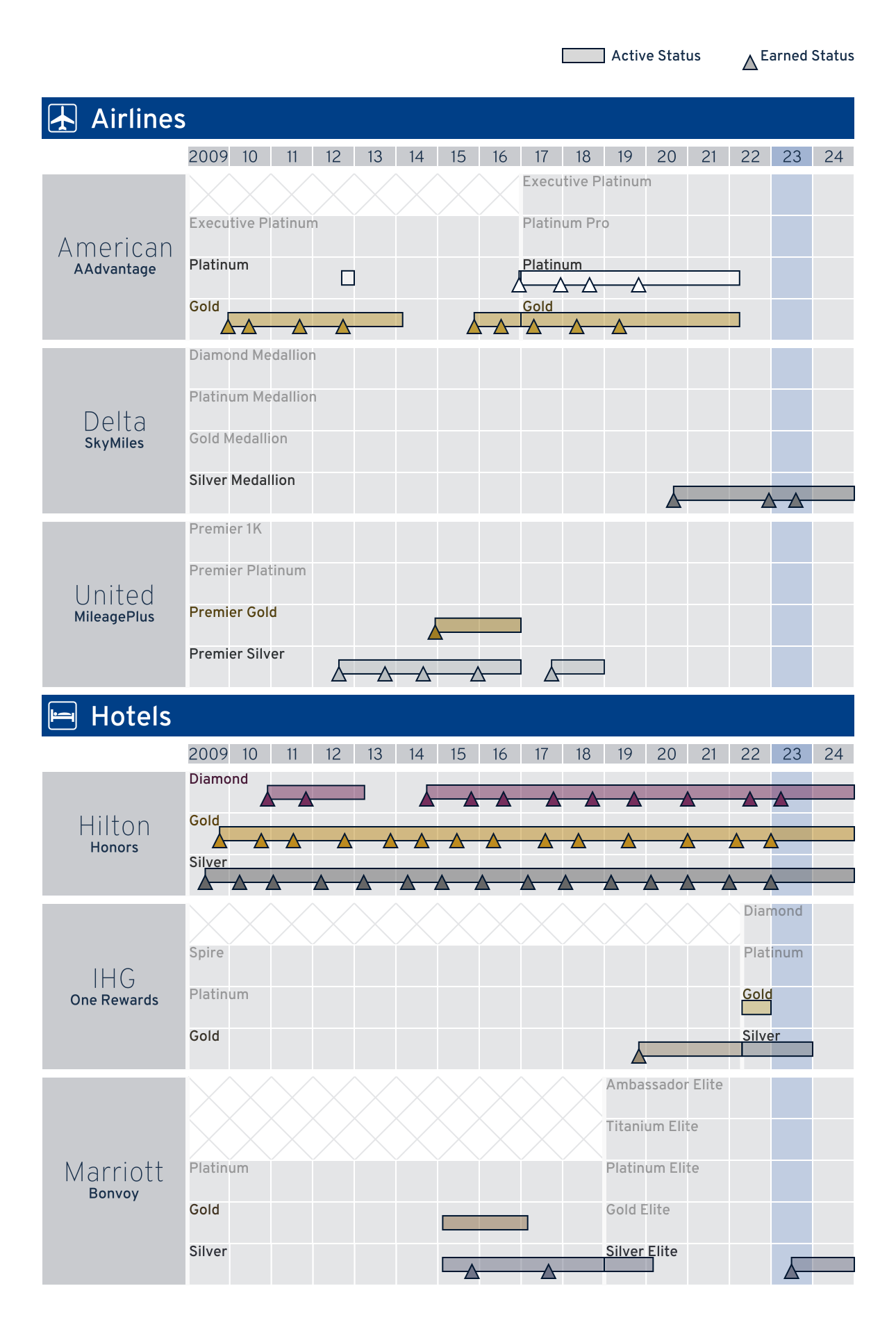
Frequent Traveler Status. My status with airline and hotel loyalty programs. 2023 is highlighted.
Airline Loyalty Programs
I re-earned Silver Medallion status on Delta SkyMiles with my August trip to Anchorage.
As with last year, my travel style of many short inexpensive flights did not work well with American Airlines AAdvantage’s loyalty points system. Even my longest trip to Okinawa, Japan, booked through American Airlines, only earned me 9300 of the 40 000 loyalty points needed for AA’s lowest-tier Gold status. (If I’d done that same Japan trip four times in one year, it still wouldn’t have been enough to qualify for status!) As of the end of the calendar year I have 24 145 of the 40 000 loyalty points needed for Gold, and though I have until 29 February to earn them, it’s unlikely I will.

Airline Lifetime Miles
I still haven’t earned enough lifetime miles on any airline to get any sort of lifetime status. American, United, and Delta all award some form of lifetime status at a million miles flown; at just over 400 000 miles on AA, I’ve still got a long way to go.
Hotel Loyalty Programs
I easily re-earned Hilton Honors’s highest tier of Diamond. (I technically only had 59 of the 60 nights required, but I had rollover nights left over from last year to get me to the finish line.)

Hilton Lifetime Diamond Progress
Hilton Honors also offers a lifetime Diamond status which requires 10 years of Diamond (which I’ve completed) and 1000 total nights stayed (I have 983 nights). I only need seventeen more Hilton nights to reach lifetime status, so I’m likely to achieve that in 2024.
I was also able to earn Silver Elite status with Marriott Bonvoy.
Trivia
- My longest flights were my transpacific flights from Dallas/Fort Worth (DFW) to Tokyo-Haneda (HND) and back, at 6448 mi (10 377 km) each.
- My shortest flights were my intra-Iceland flights from Reykjavík–Domestic (RKV) to Akureyri (AEY) and back, at 154 mi (247 km) each.
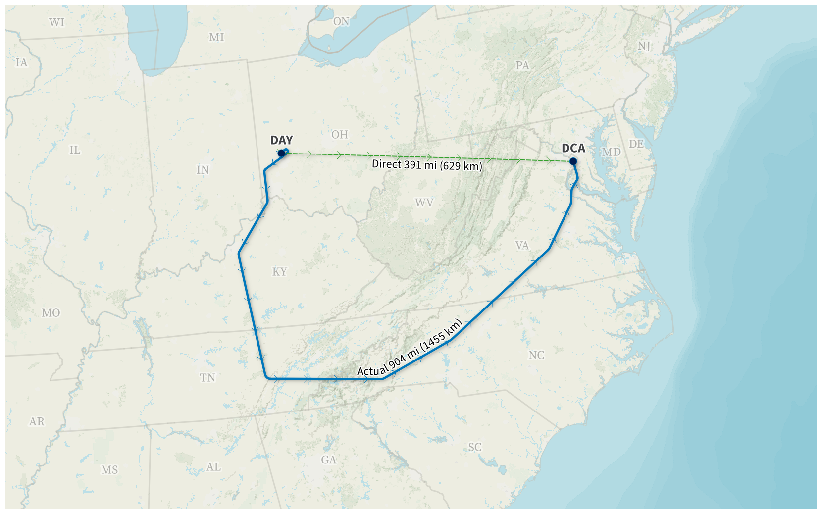
Most Circuitous Flight. My most circuitous flight was from Dayton (DAY) to Washington–Reagan National (DCA) on 6 March. Our flight had to take off with a full load of fuel (the reason why was not made clear to us), and so we had to take a lengthy route to burn off enough fuel to be light enough to land.
Actual flight path provided by AeroAPI • Basemap © Mapbox © OpenStreetMap (Improve this map)
-
Since the chart only plots one point for each calendar day, it only shows locations where I spent the night (essentially, it’s a chart of where I woke up each morning). Although I didn’t spend the night there, I took a day trip to Akureyri (3092 mi or 4976 km away from home) on my Iceland trip. If I had spent the night there, it would have been my second farthest night away from home, as it’s just two miles farther away from my home than Anchorage. ↩︎
-
The go-kart had a license plate, required a driver’s license (and an international driving permit), and operated on the streets with normal traffic, so I counted it as a rental car in my driving log. ↩︎

